III-126
DISPLAY SEA NAVIGATION
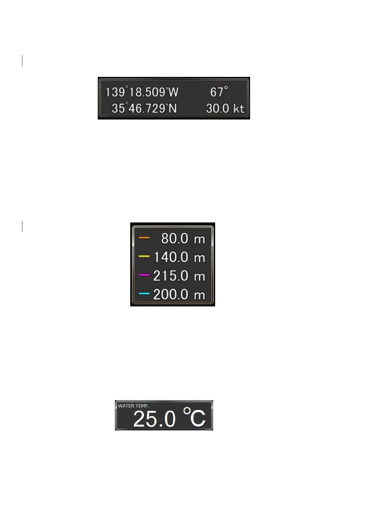
With DISPLAY SEA NAVIGATION, the location information, curse and speed
of the ship obtained from the GPS, etc. are displayed on the ES screen.
Fig. 3-11 SEA NAVIGATION display screen
* In case of measurement failure, data are displayed as follows:
Latitude and longitude : xx°xx.xx′N/S, xxx°xx′xxx′E/W Bow direction :
***°Vessel speed : **.*kt.
DISPLAY NET DEPTH
With DISPLAY NET DEPTH, the sea depth information sent from the Net
Finder (manufactured by SONIC CORPORATION) and other net depth gauges
can be displayed on the NET DEPTH screen.
Fig. 3-12 NET DEPTH screen
This system can be connected to up to 4 net finders, which are displayed in the
following colors. The setting method is described in Section 4-4.
Net finder 1 : Orange Net finder 2 : Yellow
Net finder 3 : Purple Net finder 4 : Blue
DISPLAY WATER TEMP.
This function displays the water temperature of the sea.
Fig. 3-13 WATER TEMP. display
* In case of measurement failure, it is displayed as **.*°C.
The setting method is described in Section 4-5.