Step 3
Place the mesh access point placemarks in the new folder. Save the folder as a .KML file.
Step 4
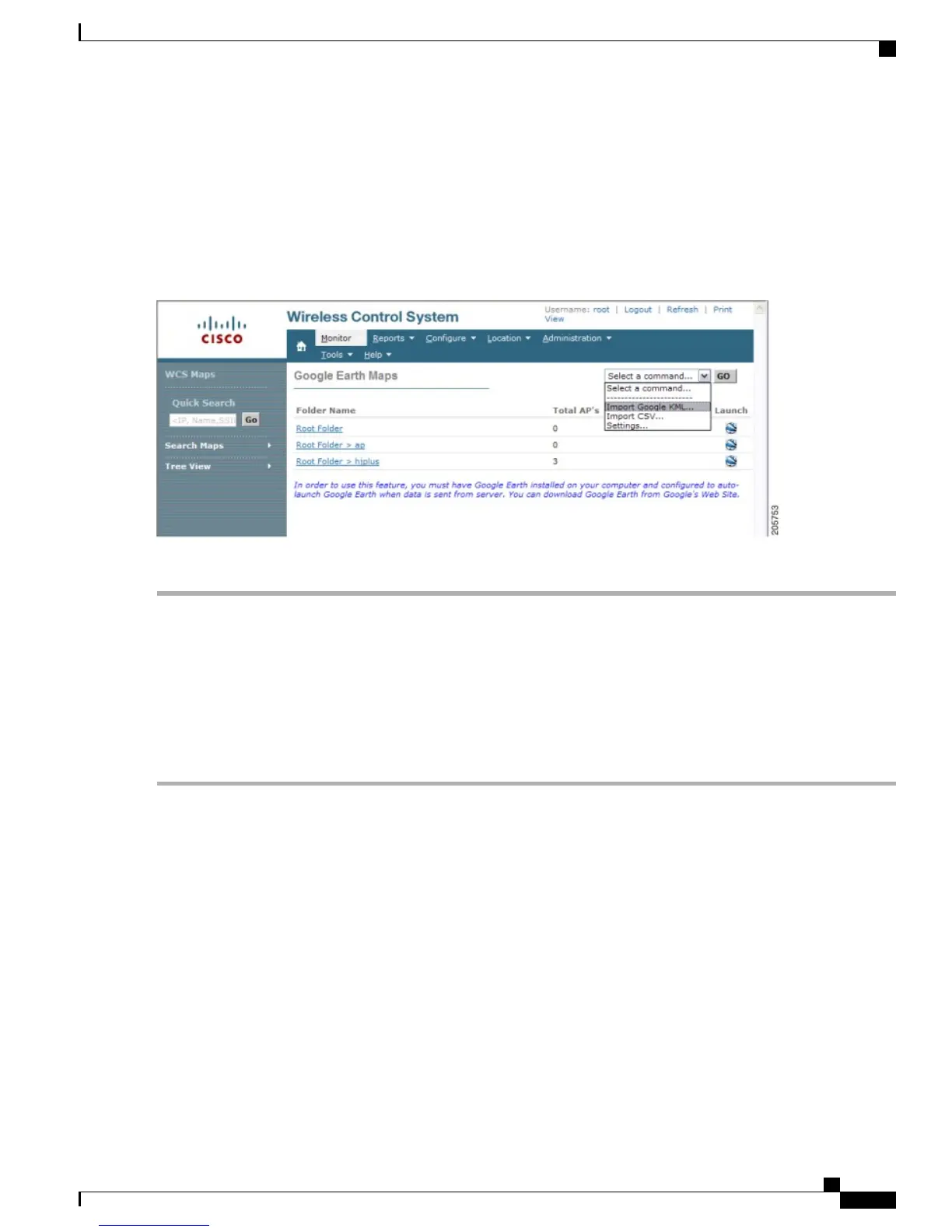
In the Prime Infrastructure, choose Monitor > Google Earth Maps. Select Import Google KML from the Select a
command drop-down list.
Step 5
Import the new Google KML folder. It displays in the folder name summary.
Figure 93: Importing New Folder into Google Earth
Step 6
Click the launch icon next to the new folder to launch the Google Earth map from the Prime Infrastructure.
Viewing Google Earth Maps
You can view campus maps, mesh access point and link information using Google maps.
To view Google Earth maps, follow these steps:
Step 1
Log on to Cisco Prime Infrastructure.
Step 2
Choose Monitor > Google Earth Maps. The Google Earth Maps page displays all folders and the number of mesh
access points included within each folder.
Step 3
Click Launch for the map you want to view. Google Earth opens in a separate window and displays the location and its
mesh access points.
Cisco Mesh Access Points, Design and Deployment Guide, Release 7.3
OL-27593-01 233
Managing Mesh Access Points with Cisco Prime Infrastructure
Viewing Google Earth Maps