Do you have a question about the Garmin GPSMAP 396 and is the answer not in the manual?
Guide to understanding the navigation system's operating procedures.
Explains the use of 'Warning' and 'Caution' terms for hazardous situations.
Details safety precautions for unit installation in vehicles, avoiding obstruction and airbags.
Emphasizes driver awareness and avoiding distraction during navigation.
Provides guidelines for safe handling, storage, and disposal of the internal lithium-ion battery.
Details map data currency, TFR data, and California e-waste recycling information.
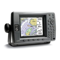
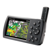
Introduces the GPSMAP 396, its features, and physical components.
Instructions on how to charge the unit's battery and information about Charge Mode.
Steps for powering the unit on/off and the initial setup process.
How to control the unit's screen brightness and audio volume levels.
Explains how to interpret satellite acquisition, receiver status, and accuracy indicators.
Details options for the GPS tab, including Simulator, WAAS, and Skyview settings.
Provides advice on signal acquisition, interference, and learning about GPS.
Explains the function of each key: PAGE/MODE, QUIT, ENTER/MARK, MENU/WX, POWER, IN/OUT, ROCKER.
Defines terms like Highlight, Field, On-Screen Button, Scroll Bar, and Default used in the manual.
Explains how to navigate menus, select options, and interact with on-screen buttons.
Details the process of entering data into a field using the ROCKER and ENTER keys.
Information about the built-in Jeppesen, Obstacle, and Terrain databases.
Instructions on how to activate Simulator Mode via the GPS or Setup tab.
How to set a new simulated location using the map or airport identifier.
How to adjust simulated speed, heading, and altitude on Panel, Pointer, or Highway pages.
Overview of the five main pages in Aviation Mode: Map, Terrain, Panel, Active Route, Position Data.
Step-by-step guide to selecting a destination airport or navaid for direct navigation.
How to select recent or user-created waypoints for direct navigation.
How to access detailed information for a selected destination waypoint.
How to view usage restrictions for airport communication frequencies.
Lists categories for finding nearby points like airports, weather sources, VORs, and NDBs.
How to choose a nearby point or airport as the navigation destination.
How to access detailed information for nearby points on the map.
How to find and view communication frequencies for FSS and ARTCC points.
How to view airspace alerts, including status and time to entry.
Describes the real-time moving map, its operating modes, and data fields in Aviation Mode.
Explains map orientation settings: North Up, Track Up, and Course Up.
How to use IN and OUT keys to adjust the map's zoom range.
How to move the map view using the ROCKER to explore different areas.
How to select and view details of waypoints or map items directly from the map.
How to retrieve and view airspace information directly from the Map Page.
How to remove map items like highways and airspace boundaries to simplify the display.
How to measure the bearing and distance between two points on the map.
How to set the bug indicator for bearing or course to steer on the HSI.
How to adjust map display options, including tabs and fields.
How to change the layout and data fields shown on various pages.
How to review and change data card information and map family settings.
Explains terrain shading (red/yellow) and obstacle display based on altitude.
Describes how obstacles are shown, standard chart symbols, and altitude labeling.
How alerts for terrain, obstacles, and descent rate appear and are managed.
Accessing options like decluttering the map and disabling alerts.
Configuring Caution Elevation, Look Ahead Time, and Alert Sensitivity.
Explains the Horizontal Situation Indicator (HSI) and Course Deviation Indicator (CDI) on the Panel Page.
How to set the bug indicator and adjust the CDI scale for the Panel Page.
How to manually set a course to a destination waypoint using Set OBS and Hold.
Explains the VNAV feature for guiding altitude changes during flight.
How the VNAV indicator appears and is used on the Panel and Map Pages.
How to configure VNAV settings such as Target Altitude and Waypoint.
Menu options for editing routes, adding waypoints, and selecting approaches.
Options for setting page layout, changing data fields, and resetting trip data.
How to view recorded flights and delete flight entries from the log.
How to enter and save aircraft profiles, including cruising speed and fuel flow.
How to perform weight and balance calculations for pre-flight preparations.
How to use the E6B tab to calculate density altitude, true airspeed, and winds aloft.
Step-by-step guide for calculating true airspeed and density altitude using E6B data.
Step-by-step guide for calculating winds aloft using E6B data.
How to enable and display the XM Audio Page from the Main Menu.
Customizing XM Audio Page settings like adding favorites and scanning channels.
How to add, view, select, and delete favorite XM Radio channels.
How to scan all channels, by category, or by favorites.
How to mute or enable audio output for XM Radio.
Overview of main pages in Automotive Mode: Map, Trip Computer, and optional pages.
How to select a map item and start navigation to it using Direct To.
Steps to start a new route by selecting waypoints from the Find Menu.
How to search for items like cities and route to them using the Find Menu.
Description of the Find Menu categories for searching waypoints and points of interest.
Using the Find Menu to search for items relative to a map pointer location.
How to find items near a different map location or near a previously selected item.
How to view and manage a list of recently searched or navigated items.
How to access and view detailed information pages for selected items.
Additional options for the Find Menu, including auto-arrange and near-destination searches.
How to create a route by selecting waypoints using the Find Menu.
How to create a route by selecting locations directly on the map.
How to activate and follow a previously created route.
How to save your current location as a waypoint using the ENTER/MARK key.
How to create waypoints by selecting map features or locations on the Map Page.
How to manually enter latitude/longitude coordinates to create a waypoint.
How to monitor route progress using the Map Page and magenta line.
How to view trip statistics using the Trip Computer Page.
How to specify roads or areas to avoid during navigation and route calculation.
How to create a detour around road construction or closures.
How to add intermediate stops (Via Points) to a route.
Overview of the Map Page in Automotive Mode, including location marker and data fields.
How to use the Highway Page for digital and graphic steering guidance.
Options for defining data fields and selecting waypoints/tracks on the Highway Page.
How to save the current route from the Current Route Page.
Options for setting page layout, changing nearest type, and resetting trip data.
How to view the list of all saved routes in the unit's memory.
How to set route leg transition or manually transition to the next waypoint.
How to select and navigate a saved route, including following roads.
How to change the name of an existing route using the Route Review Page.
How to review specific points within a route and access their details.
How to insert new waypoints into an existing route.
How to visually edit a route's path on the map interface.
How to enter speed and fuel flow data for trip planning.
How to view waypoint details by highlighting them on the Map Page.
How to access the page for editing waypoint details like name, symbol, and location.
How to modify a waypoint's name, symbol, and other associated data.
How to display a selected waypoint on the map and view its details.
How to append a selected waypoint to the end of a route or add it to the current route.
How to calculate a more accurate waypoint location by taking multiple measurements.
How to create a new waypoint by projecting distance and bearing from a specific location.
How to create and manage categories for organizing waypoints.
How to delete an entire category of waypoints.
How to assign a waypoint to a specific category for better organization.
Overview of the User Points tab for managing waypoints, including review and editing.
How to initiate navigation to a waypoint directly from the User Points list.
How to delete waypoints from the list or the Waypoint Page.
How to delete waypoints based on their symbol or category assignment.
How to delete waypoints within a specified distance from a reference location.
How to define alarm circles around waypoints to alert proximity.
How to enable/disable proximity alarms and add proximity waypoints.
How to remove single or all proximity waypoints from the list.
How to set track recording modes, intervals, and save track logs.
How to clear the current track log to make space for new recording.
How to save the entire track log or specific portions of it.
How to review, edit, and manage saved tracks.
How to retrace a saved track log using the TracBack function.
Overview of the main pages in Marine Mode: Map, Compass, Highway, Active Route, Position Data.
How to initiate Man OverBoard navigation for emergency situations.
Details the Map Page in Marine Mode, similar to Aviation Mode but with a triangle marker.
How to customize the Compass Page display, including course pointer and bug indicator.
How to use the timer feature, specifically designed for sail boat racing.
Allows control and setup of Digital Selective Calling features for transmitting/receiving location info.
Explains distress calls, position reports, and how they are received and displayed.
How the unit stores and displays received DSC calls in lists and logs.
How to add, delete, and manage DSC directory entries like a phone book.
How to navigate to a location from a received DSC call or position report.
How to turn DSC on/off and simulate distress calls for practice.
Provides a visual reference for satellite acquisition, receiver status, and accuracy.
How to view individual weather features on the Map Page, like Storm Cells.
How to view and select XM Radio channels and services.
How to view radio ID, subscription info, and weather products.
How to view a list of recorded flights, including date, route, and flight time.
How to create and store up to 50 reversible routes with up to 300 points each.
How to manage waypoints using User and Proximity sub tabs.
How to specify track log recording, define its format, and save data.
Options for the Sonar Page, including setup and display settings.
Information on aircraft profiles and weight & balance calculations.
How the E6B tab calculates density altitude, true airspeed, and winds aloft.
How to set and manage various alarms, including persistent alarms.
Configuration for airspace alerts, including enabling/disabling and setting altitude buffers.
Settings for alarms related to navigation, such as next turn, arrival, and off course.
Settings for system-related alarms like clock, external voltage, and GPS accuracy.
How to set alarms for weather events like tornadoes, thunderstorms, and floods.
Settings for sonar alarms, including shallow water, water temperature, and drift alarms.
How to view sun/moon rise/set times and moon phases for different dates and locations.
How to view sun and moon information for locations other than the current one.
How to view tide station information and graphical charts for different dates.
How to select tide stations, dates, and times to view tide charts.
How to view predictions for good and best times to hunt and fish.
How to view generated messages and their detailed information.
How to show or hide specific types of messages using the log filter.
How to adjust screen features like page sequence, color mode, and backlight.
Configuration for twilight adjustment, backlight timeout, and enabling pages.
How to customize unit sounds, including beeper, attention tone, and voice prompts.
Settings for terrain audio, TIS audio, speaker volume, and audio jack type.
How to customize system settings like operating mode, usage mode, and WAAS.
Settings for route calculation preferences and methods, including avoids.
How to configure off-route recalculation and next turn window behavior.
Settings for user timers, marine timers, and fuel tank reminders.
How to set time format, time zone, and daylight saving time.
How to customize measurement units for speed, distance, temperature, and altitude.
Information on location formats, map datums, and coordinate systems.
How to choose between Auto Mag Var, True, Grid, and User Mag Var for heading references.
How to enter personal information to be displayed when the unit is turned on.
How to control input/output formats for connecting external devices and setting serial data formats.
How to set output rate, precision, and NMEA sentences for interfacing with other equipment.
How to turn XM Weather information on or off on the Map Page.
How to adjust weather item display and zoom ranges on the Map Page.
How to turn weather data on/off and set zoom ranges for weather features.
How to set zoom ranges for aviation weather information like METAR, AIRMET, SIGMET.
How to set zoom ranges for surface weather information like winds and fronts.
How to set up marine weather options like water temperature and wave period.
How to view specific weather types like Storm Cells on the map.
How to view current conditions and forecast maps for selected locations.
How to view radio ID, service level, and weather products from the XM Tab.
How to view software version information for the GXM 30/30A antenna.
How to view current conditions and forecasts for your present location.
How to view detailed weather forecasts, including temperature and precipitation chances.
How to view sea surface conditions, including water temperature and pressure.
How to view marine weather bulletins and their full text.
How to find weather data for locations other than the current one using the Find Menu.
How to change the Map Page layout to display a split screen with sonar data.
How to adjust the size of the sonar display within the split screen view.
How the GPSMAP 396 functions as a fishfinder/flasher with the Sonar Page.
How to access and use the Adjustment Menu for sonar settings like Range, Zoom, and Gain.
How to access the Sonar tab in the Main Menu to configure Sonar Page settings.
How to set fish symbols and water type for optimal sonar display.
How to configure depth update rate, map detail, keel offset, and transducer type.
How to calibrate the unit's water speed sensor for accurate readings.
How to set the scale, color bar, and flasher display for the sonar screen.
How sonar works, including transducer beam patterns and display representation.
How cone angles and frequencies affect sonar coverage area and detail.
How to interpret bottom types with whiteline and identify thermoclines using See-Thru technology.
How to use depth lines and noise rejection for clearer sonar readings.
How to adjust the size of the sonar split screen display.
How to show the pointer to mark underwater waypoints or reference sonar items.
Description of TIS service volume, horizontal range, and altitude limits for traffic advisory.
Details limitations of TIS, including its intended use and factors affecting performance.
Explains the graphical symbols and altitude deviations used for TIS traffic advisories.
Guidance on how users should respond to TIS warnings and advisories.
How traffic ground track is indicated on the screen as a target track vector.
How the Traffic Warning Window appears for imminent traffic threats.
How to display TIS traffic on the Map Page and use panning to view details.
How to output frequency data to Garmin aviation radios like SL30/SL40.
How to connect to a GTX 330 transponder for TIS traffic data.
How to connect to an SL40 or SL30 radio for frequency data output.
How to connect the GXM 30/30A antenna for XM WX Weather and XM Radio.
Details on connecting the power/data cable and its color code for harness connections.
How to connect the unit to a PC via USB or serial port, including driver info.
How to exchange images and download custom symbols using xImage.
How to install and remove optional Garmin data cards for charts and maps.
Step-by-step instructions on how to detach and reattach the GPS antenna.
Definitions of key GPS terms like Initialize, Location, Route, and Waypoint.
Explanation of DGPS stations and the need for a beacon receiver.
How differential receiver status (None, Searching WAAS, Using WAAS) is indicated.
Explanation of WAAS/EGNOS service for improving GPS signal integrity and accuracy.
Explains the LORAN TD feature for converting GPS coordinates to LORAN TDs.
How to set LORAN chain number and secondary stations before storing waypoints.
Accessing the Location Format field to set up LORAN TD.
How to change settings in the LORAN TD setup window, including chain number and stations.
Explains map datums as mathematical models of Earth used for referencing locations.
How to choose coordinate systems and formats like Lat/Lon, UTM/UPS for displaying location.
Explains MMSI numbers and their use in VHF radio communication and distress calls.
Information on how users can obtain MMSI numbers for ship station licenses.
How Garmin GPS helps with DSC calls, including Call List, Log, and Directory features.
Information on how to update the Jeppesen database online for airports, VORs, and NDBs.
Explains messages related to GPS accuracy falling outside set values and alarm clock functions.
Covers messages like Antenna Shorted, VNAV Cancelled, and Boat Not Moving Fast Enough.
Explains messages related to map unlock codes and database errors.
Covers messages related to XM antenna status and transducer connection issues.
Explains data fields like Accuracy, Bearing, Course, Course to Steer, and Cross Track.
Explains data fields for distance, ETA, ETE, elevation, and GPS status.
Terms and conditions for using the embedded software, including usage restrictions.
Information on online product registration and how to contact Garmin support.
Details the product's one-year warranty against defects and exclusions.
Further details on warranty terms, repair, and limitations of liability.
Safety considerations for using XM Services and acknowledging associated risks.
Disclaimers and limitations of liability regarding the radio service and product use.
Terms of service for XM Radio and XM WX Weather subscriptions.
Compliance with FCC rules, limits for Class B digital devices, and interference guidelines.
| Battery | Rechargeable lithium-ion |
|---|---|
| Waterproof Rating | IPX7 |
| WAAS enabled | Yes |
| Connectivity | USB |
| Display Type | 256-color TFT |
| Battery Life (low) | 4 hours |
| GPS Accuracy | Less than 15 meters |
| Memory | Internal memory |
| Preloaded maps | Yes |