394149/D
63
Coordinatesystemalternativeorigins
Ifnecessary,otheroriginlocationsmaybedenedforspecicproductsorpurposes.One
exampleistheNavigationReferencePointthatisfrequentlyused.Wheneveravessel
issurveyedtoestablishaccurateoffsetinformation,thesurveyormayalsoestablishan
alternativeoriginlocation.Wheneverrelevant,anysuchalternativelocationsmust
bedenedusingoffsetvaluestothe"ofcial"originestablishedbythedesigneror
shipyard.Acommonlyusedalternativeoriginisthephysicallocationofthevessel’s
motionreferenceunit(MRU).
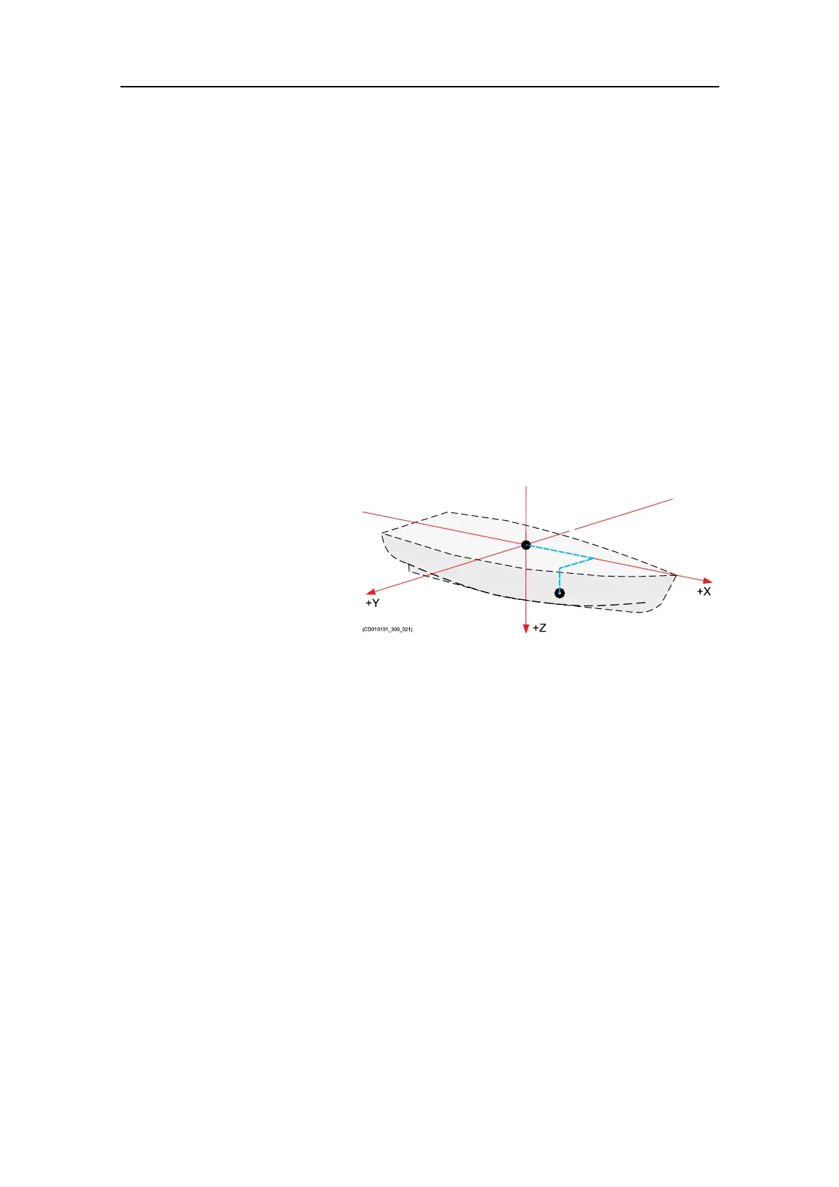
Deningthephysicallocationofeachsensor
Bymeansofthevesselcoordinatesystem,thephysicallocationofeverysensorcan
bedenedusingthreenumericalvaluesforX,YandZ.Thesevaluesmustdenethe
verticalandhorizontaldistancesfromasinglereferencepoint;theorigin.Thephysical
locationofthemotionreferenceunit(MRU)isoftenthemostimportantsensortodene.
Formanysystems,thevesselheadingisalsoacriticalmeasurement.
Illustration:
Inthisexample,asecond
referencepointhasbeen
established.Itisdenedwith
threepositiveoffsetvalues
forX,YandZ.Allvalues
arepositivebecausethenew
referencepointisinfrontof
andbelowtheorigin,andon
thestarboardside.
TheaccuracyofthethreenumericalvaluesforX,YandZdenestheaccuracyofthe
sensordata.Ifyourequireahighaccuracy,forexampleforunderwaterpositioning,
underwatermappingorscienticmeasurements,youmusthaveeachsensorpositioned
usingprofessionallandsurveying.Forsuchuse,agoodalignmentsurveyiscriticalfor
highqualityresults.Surveysarenormallydonebyqualiedandtrainedsurveyorsusing
provensurveyequipmentandmethods.
Relatedtopics
Preparations,page43
Dimensionalsurveying,page176
Preparations