Manual No. 016-3001-015 Rev. C 169
Advanced Settings and Features
7
Maps
Coverage, scout and prescription (Rx) map displays may be customized to suit the equipment operator or
application through the map option in the setup menu.
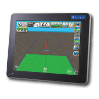
To set map display options from the Viper Pro main screen, touch Menu and select Setup and Maps.
The following actions may be performed through the Maps setup menu:
• load and delete streetmaps
• customize scout map displays
• customize coverage map displays
• customize prescription (Rx) map displays
Street Maps
The street maps feature allows the operator to view a county map on the Main tab map area display. The
current vehicle location will be displayed on the street map to assist with locating or identifying specific field or
application areas.
Note: Street maps are only displayed on the Main tab.
Maps are available free of charge for counties within the United States in a compressed, or “zipped,” format. A
program to extract, or “unzip,” these files (i.e. WinZip™) will be required to prepare the files for use with the
Viper Pro.
Note: If the computer does not already have the ability to unzip a file, a trial version of WinZip™ software
tool is available at:
www.winzip.com
A free version of an unzip program is also available from the following web site:
www.freebyte.com/fbzip/
 Loading...