PI-135 OPERATOR’S MANUAL
xviii
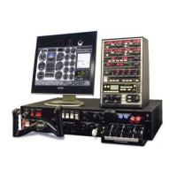
The Operator, via the IOS, can change the fl ying environment
such as winds, turbulence, icing characteristics, visibility,
ceilings and cloud layers. Any aircraft instrument, receiver
or system can be failed immediately, realistically or
programmed for a timed failure without interrupting the
student’s fl ight. Both weather and malfunctions scenarios
can be saved and re-loaded. The software contains utilities
to monitor, record and replay fl ights over a map page
displaying the horizontal and vertical fl ight paths in real
time. The navigation data is from the FAA National Flight
Data Center (US only) or Jeppesen®. The data includes
airways, intersections, published holding patterns, navaids
and airports and airport frequencies. Though designed
for instrument training and profi ciency, the visual image
is actual satellite digital elevation models with a generic
ground texture. Major roads, railroads, urban areas bodies
of water and shorelines are depicted.
 Loading...