PI-135 OPERATOR’S MANUAL
46
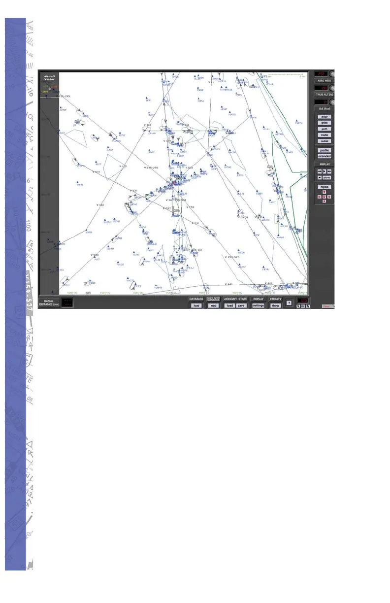
MAP PAGE
The MAP Page is a graphical representation of the fl ying
area showing navigation facilities, frequencies, lat/long,
runways, boundaries and much more. An aircraft symbol
shows the fl ight path in real time (both horizontal and vertical
profi le views) that can be replayed, saved and printed
for evaluation. Over 15 map features can be displayed
at 8 separate zoom levels. The aircraft fl ight parameters
(magnetic heading, altitude and IAS) can be set from the
map page. In addition, you can also save and load training
states or load Instrument Approach Scenarios (IAS).