10.3 Calculating Cartographic Length of Tracklogs and Routes
Cartographic length is calculated directly on the cartographic grid, and considers only Earth dimensions, not local
characteristics like altitude and meridian convergence. For further information about the difference between
cartographic surface and topographical surface, see Topographical Surface x Cartographic Surface
GPS TrackMaker® calculates the cartographic length in the following rectangular systems:
- UTM - British National Grid
- British Uniform Grid - New Zealand Grid
- Swiss Grid - Swedish Grid
- Irish National Grid - German Grid
- Finnish Uniform Grid - Taiwan 67 Grid
- Dutch Grid
GPS TrackMaker Professional® also calculates in the following systems:
- User Defined Grid
- RTM (Regional Transverse Mercator)
- LTM (Local Transverse Mercator)
- Grid of Colombia
Warning: use the specific datum of your region.
If the program is configured to geographical coordinates, the cartographic area will be calculated based on the
UTM system.
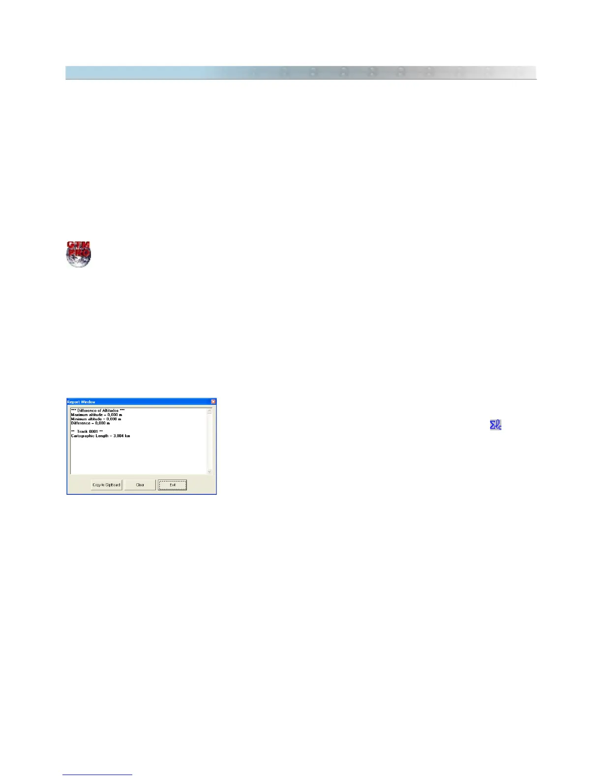
To calculate the cartographic length, select the Tracklog or Route as shown
in Selecting Data and click on the
Cartographic Length
button on the
Toolbar or in the
Tools
menu. The value will be indicated in the status bar
at the bottom of the screen, in the Length Unit of Measurement, as well in
the Report window.
TIP: The calculated length can be indicated on the screen as a Waypoint. When creating the Waypoint, just click
on the
comments
textbox and, using the arrow keys, select the value. When length and area are calculated, the
values are registered (hidden) in the textbox of the Waypoint
comments
.
Warnings :
Sub metric accuracy is only obtained with topographical equipment like Total Station or Differential GPS that cost
much more than a small handheld GPS. So, for tasks that demand accuracy, the handheld GPS must be used only
as a support tool and not as main equipment.
Many handheld GPS don't transfer altitudes (relative and absolute) of each point to the program. So, the distance
calculation cannot consider the natural ground elevations. In these cases, the values refer only to the horizontal
distances.
Changes in the datum can produce differences in length calculations. This happens because each datum may have
a proper value from the Earth semi-axis and of its flattening, it can be seen in Datum Table. Use the specific
datum of your region.
119