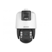
4.14 GPS Calibraon
GPS calibraon is used to map the geographical locaon to the camera scene so that the device
can calculate the real-me geographic informaon of targets. This funcon is only supported under
cert
ain VCA resource opons.
4.14.1 Set GPS
Calibraon
Before You Start
Choose at least 4 calibraon points on the ground in the monitoring scene and measure the
precise longitude and latude of the points. The calibraon points should scaer in a 2 × 2 or 3 × 3
array.
Steps
1.
Go to Conguraon → Calibrate → GPS Calibraon → Calibraon .
Note
The PTZ control is automacally locked to avoid interrupon during conguraon.
2.
Select the longitude and latude type according to device locaon.
3.
Se
t calibraon points.
1) Adjust the pan, lt, and zoom to nd the scene with a calibraon point.
2)
Click
and click on the calibraon point on the live image.
The select
ed point is zoomed in and placed in the center of the image.
3) Click
again.
A gr
een cross shows on the point.
4) Click Add and input the precise longitude and latude of the point.
Note
You must add at least 4 points, otherwise you cannot save the points.
5) Click to save the pan, lt, and zoom value of the point.
6)
Click Save.
7) Repeat the steps to set other calibraon points.
4.14.2 Verify Calibraon
Before You Start
Choose vericaon points on the ground in the monitoring scene and measure the precise
longitude and latude of the points.
St
eps
1.
Go to Conguraon → Calibr
ate → GPS Calibraon → Calibraon Vericaon .
TandemVu PTZ Camera User Manual
27
 Loading...