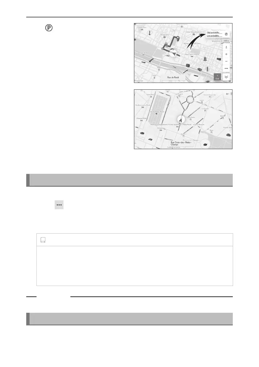
Touch [ ] on the map screen.
On street parking is displayed on the
map. Depending on the availability of
parking, the displayed color will change.
●
On street parking will not be displayed when the map scale is 1/5,000 or more
(scale display is 50 m (150 ft.) or more).
Displaying the driven route (route trace)
Approximately 1000 km (600 miles) of a driven route can be saved and displayed.
1 Touch [
] on the map screen.
2 Touch [Display map].
3 Touch [Route trace].
INFORMATION
● If the driven distance saved exceeds the limit, the oldest route trace will be
deleted and the newest route trace will be saved.
● The driven route can be displayed with a map scale between 1/2,500 and
1/5,120,000.
Related Links
Map display settings(P. 151)
Speed cameras
*1*2
Speed cameras can be displayed as icons on the map.
4-2. Map information
152