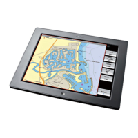
3.49 Chart: Waypoints
Waypoints are virtual locations you mark on your Chart in order to
show favorite, safe or noteworthy locations.
You can use the waypoints to create navigation routes, name a
waypoint, record information about a waypoint, or set conditional
display options. Waypoints are stored in the Waypoints Library.
3.50 Chart: Create a waypoint or event mark
You can create a waypoint anywhere on the Chart pane except in
the shaded frame around the edge.
An event mark is a waypoint created at your vessel's current
position.
¾
To create a waypoint or event mark:
• Make the Chart pane active.
• Position the cursor where you want the new waypoint.
• Select Plot Waypoint Here.
The GB40 immediately creates the new waypoint. The
Waypoint Details box is displayed with some details (such as
the latitude and longitude of the waypoint) already entered.
• Edit the waypoint information if you wish.
• When you are finished, select
Return.
¾
To create an event mark:
• Make the Chart pane active.
• On the OP30, press and hold down the
Plot / Mark button.
Otherwise, select
Mark.
The GB40 immediately creates the new event mark.
3.51 Chart: Edit a waypoint/event mark
You can change the waypoint name and icon, write notes about
the waypoint, and change the Lat/Long coordinates.
The changes are global and are saved in the Waypoints Library.
Note: If you're using Phantom Loran, the TDs and GRI settings
are also shown. If you change the waypoint's Lat/Long
coordinates, the TDs will be updated. If you change the TD's,
the Lat/Long will be lost.
Chart |77