3
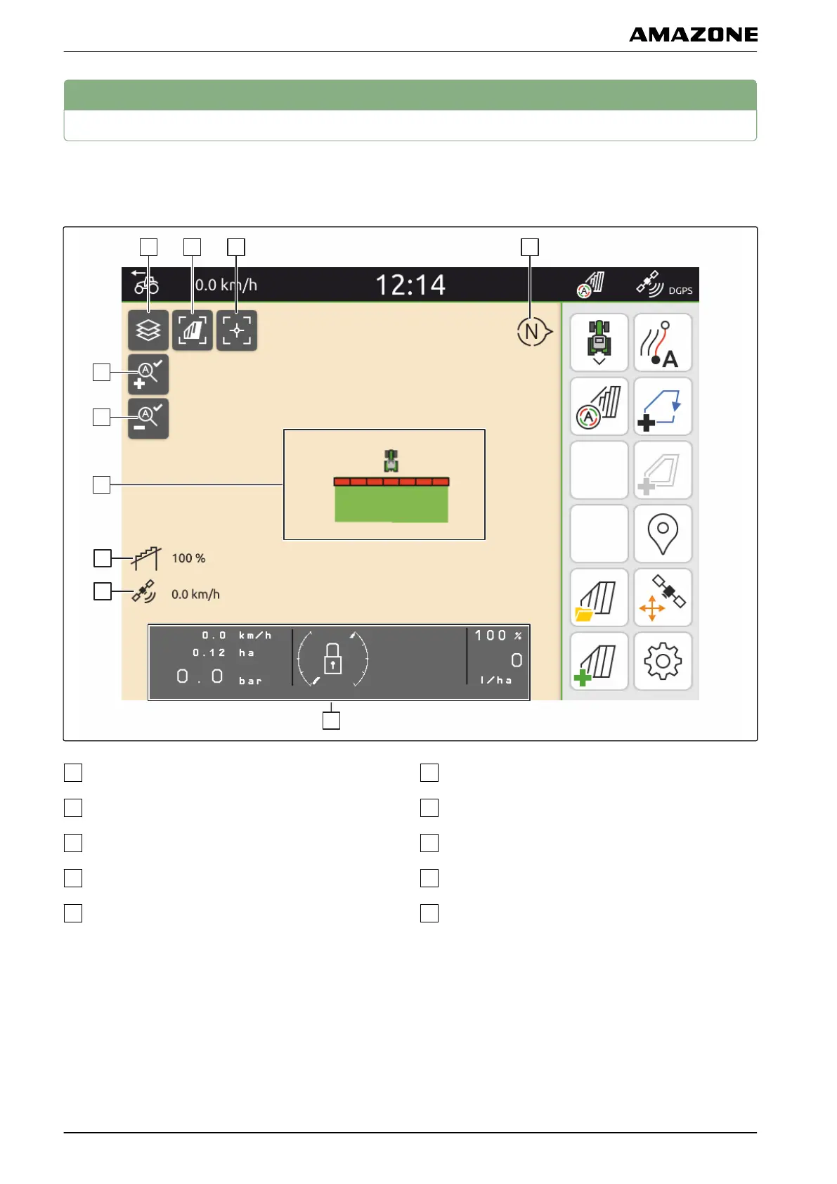
Map view
3.1 Map
Select map layers
Activate bird's-eye view
Focus on the tractor and implement
Compass
Define the maximum zoom level
Define the minimum zoom level
Symbols for tractor and implement
Degree of overlap
GPS speed
Implement information
CMS-T-00000241-C.1
CMS-T-00000242-B.1
D | Operator interface overview | Map view
MG6010-EN-GB | G.1 | 13.12.2018
14