LX8000 version 0.96 April 2008
Page 26 of 85
• Arrival altitude shows arrival altitude, taking into account current MacCready setting,
safety altitude and current wind. Due to complexity of calculation, it will not take into
account wind profile.
• Required altitude shows how much height is needed to reach point. Required altitude
takes into account current MacCready setting, safety altitude and current wind. Due to
complexity of calculation, it will not take into account wind profile.
• Required Mc gives an estimate, what is maximum MacCready value, which we can use
to reach point.
• Required L/D shows required glide ratio to point taking into account safety altitude
• Frequency will display point frequency, if available.
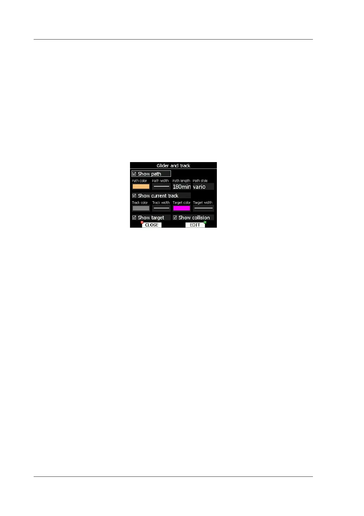
5.1.6.4 Glider and track
LX8000 can show colorized path flown, current track vector and target vector with terrain
collision warning.
Check show path item, if you want to see flown path. Path length defines, how much of
flown path will be shown. Path can be colorized using:
• Vario path style, where red colors indicates positive vertical speed and blue colors
negative vario speed.
• Mc path style, which is based on current MacCready settings. Red color indicates part of
flight where, we have vertical speed higher then current MacCready setting. Orange
color shows for vertical movements about same size as current MacCready setting and
blue for vario below MacCready setting. Gray color depicts sink area
• Fixed path style. Path color is fixed and defined by path color item.
Check show current track item if you would like to see your current ground track vector.
Track color and width defines color and width of current track vector.
Selected target and current position are connected with magenta line. Check show target,
if you would like to see this line. In the target color and target width you can select the
Color and Width of this line. You can also choose to show or hide the Terrain collision point
and the target line itself. The Terrain collision marker is a red square which is only displayed
when there is terrain between navigational point and current positions and therefore not
enough altitude to reach the target with the current glider settings
5.1.6.5 Optimization
LX8000 is calculating optimized flown distance according to OLC or FAI rules in real-time
during flight. (See chapter 5.1.9). It also calculates FAI area, which is actual FAI triangle
assistant. If you enter this area and return to start point, your flight forms triangle according
to FAI rules. Optimization dialog is used to setup look and feel.