LX8000 version 0.96 April 2008
Page 41 of 85
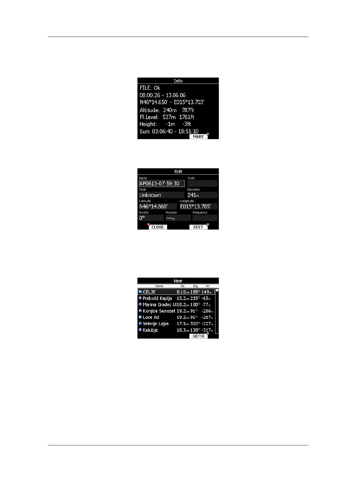
5.2 Information mode
Informational mode displays GPS status, altitude, flight level and height. Sunrise and sunset
are calculated for current position.
If you press MARK button, new waypoint will be created with current latitude and longitude
and elevation based on terrain database. Waypoint name is generated from current date and
time.
If style is different from Unknown, waypoint will be stored and saved to active waypoint file
5.3 Near mode
List of all landable waypoints and airports is shown in this mode. Points are sorted according
to arrival altitude.
Select preferred landable place with bottom-right knob and press GOTO button. It will
automatically change to airport mode and navigation will commence to selected point.
Duplicates are automatically removed. If target with nearly same latitude and longitude is
found in LX navigation’s Airports database and user waypoint file, user waypoint file will be
displayed.