LX8000 version 0.96 April 2008
Page 24 of 85
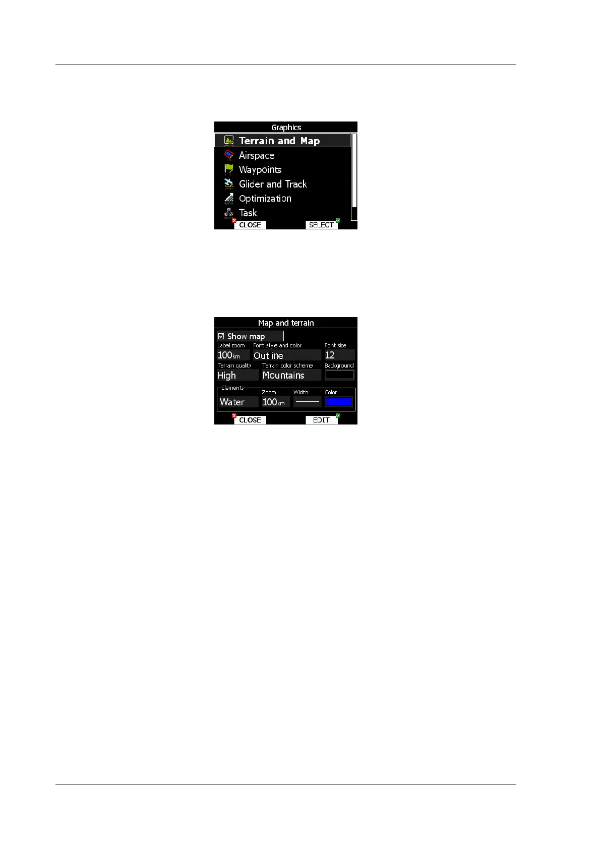
5.1.6 Graphics
This dialog allows user to setup the appearance of the map in navigational mode. Choose
Graphics menu item and press SELECT button. Submenu will open.
5.1.6.1 Terrain and Map
LX8000 is preloaded with terrain for whole Earth. Database includes elevation contour lines,
water bodies, roads, highways, railways, big cites and digital elevation model. Database is
derived from VMAP0 free database and some data may be obsolete. Database can not be
modified by user.
Check Show map item to enable map displays in navigational pages. If item is unchecked
no map will be displayed. The zoom defines up to which scale of zoom city names are
visible. 100km means the whole width of the screen represents 100km. The user can also
modify size, font style and color by Font style and color item. Use left-bottom knob to
modify color and right-bottom knob to modify style.
Terrain can be rendered in three different levels. Higher level means more details. LX8000 is
optimized to work with high terrain quality. If off option is selected, no terrain will be shown,
only water bodies, roads, railways and cities.
Background color is defined by Background item. Default background is black.
Colors of terrain can be changed using different terrain color schemes. The following color
schemes are available:
• Mountain is default setting with colors from green to white at 2000m.
• Flatland is setting where colors are changing up to 1000m.
• Low contrast, same as Mountains but colors are not so intensive.
• High contrast, same as Mountain but colors are more intensive and from 0-100m,
white color is used.
• Zebra alternating colors are used.
• Zebra 2, less intensive alternating colors are used.
In Elements group lands features are setup separately. Zoom defines up to which zoom
level selected land feature is visible. Also line width and color can be setup.