LX8000 version 0.96 April 2008
Page 25 of 85
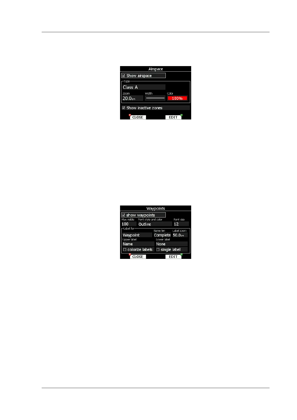
5.1.6.2 Airspace
In this dialog, you can setup airspace map presentation. Check Show airspace item to
enable airspace displays in navigational pages. If item is unchecked, no airspace will be
displayed.
In the Type panel you can setup how each airspace type is displayed. You should setup
each type of airspace zones separately. First choose an airspace type from the list. Using
Zoom spin setups to which zoom level this type is going to be visible. Color item specifies
airspace zone color. You can also modify transparency of selected type. Turn bottom-left
knob to change value of transparency. 100% means completely transparent and only
airspace zone outline will be shown. 0% means completely solid. (Not recommended). If
Show inactive zones option is checked then airspace zone with proximity warning
switched off will be shown.
5.1.6.3 Waypoints
Waypoint look and feel is setup in this dialog. Check Show waypoints item to enable
waypoints display in navigational pages. If item is unchecked no waypoints will be displayed.
Max.visible item defines how long waypoint labels and detailed symbol are shown. If
maximum number of waypoints on current screen is more then defined value, only small
blue dots will be shown for waypoint and no labels will be drawn.
Font style, color and size can be defined using next Font style and color item and Font
size item. When editing style, turning bottom-left knob will change color of font.
Waypoint labels can be setup to give even more details. Label details can be setup for each
individual waypoint type.
Label consists of two selectable values, upper label and lower label. If you prefer to have
label in single line, single label checkbox should be checked. Label can also be colorized.
Check Colorize label item. Colorized labels are drawn with green background, when
waypoint is in reach with current MacCready settings and with yellow background, when
waypoint is in reach with MacCready settings zero. No background is shown, if waypoint is
not reachable.
Label is selected from following options:
• Name, waypoint name is shown. Name length items controls, how name is displayed.
• Code, will display ICAO code or short name
• Elevation, shows waypoint elevation