110
Trinity F90+ user manual
10.4 POST PROCESSING
In order to post process the geotagged pictures please use a third party software like Agisoft, Pix4D, Propeller Aero or Trimble
business Center.
For optimal accuracy results the recommandation is to adjust the accuracy settings in the software.
Therefore, please see the following screenshots:
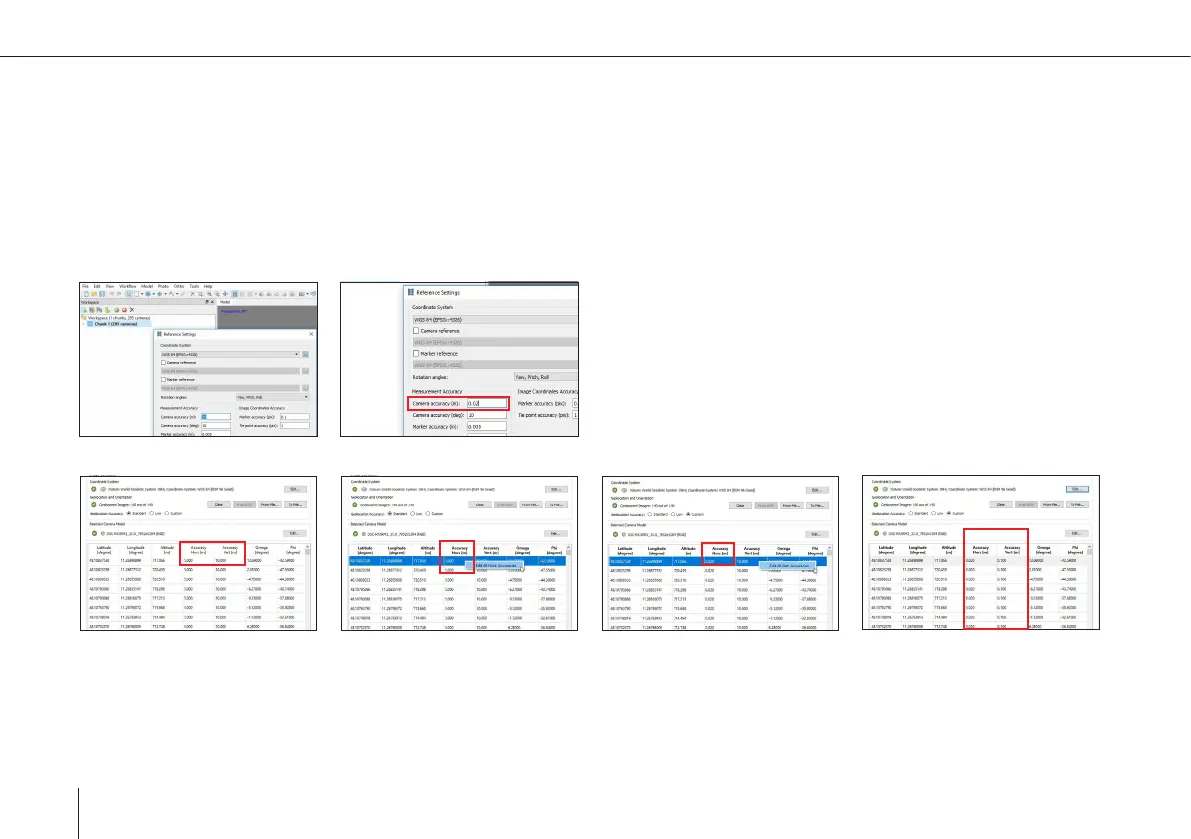
Agisoft Accuracy
Pix4D Accuracy
Adjust camera accuray to 0.02 m
Edit all horizontal accuracy
Adjust to 0.020 m
Edit all vertical accuracy
Adjust to 0.100 m