53
Trinity F90+ user manual
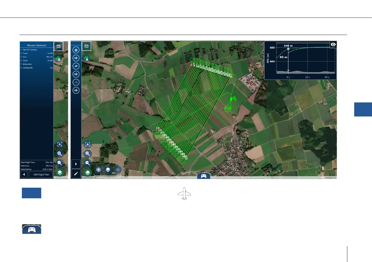
7.2.4 Monitoring screen
Plot
Live Elevation Plot (Plots)
• Current altitude above ground (AGL)
• Current altitude above mean sea level (MSL)
• Altitude of the last 10 seconds
• Predicted altitude for the next 50 seconds.
UAV Type
• Displays wind speed, direction, groundspeed &
airspeed
• Transparent UAV icon: estimated shadow
(based on time & coordinates)
Mission & Emergency Commands
QBase – Ground Control Station
7