62
Trinity F90+ user manual
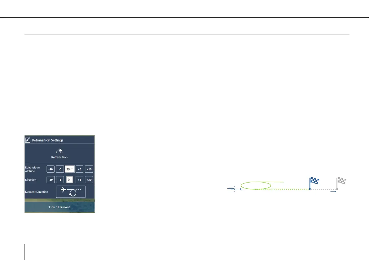
Take-Off /Landing – Retransition
Retransition Waypoint
During the retransition the UAV will switch from aero xed wing mode to hover mode. The retransition waypoint is the location
at which the UAV nishes the retransition. At this location the UAV is in hover mode. The retransition track is indicated by the
dotted path and is by default 150 m (492 ft).
• The retransition waypoint should be located close to the home waypoint (take-off and landing location) (ideal <50 meters; max.
100 meters). The distance between the two waypoints is covered in high energy demanding hover mode.
• Depending on the wind condition, the real retransition location might not comply with the retransition waypoint in QBase.
• If there are obstacles in an area with a radius of 50 meters (164 ft) around the retransition waypoint, make sure that the
retransition altitude is 20 meters (65.6 ft) higher than the obstacles are.
• Select the Take-Off or the Retransition location on the map or select Take-Off/Landing in the left section in order to set the
waypoint settings.
Retransition Altitude ATO (above take-off)
Denes the hover altitude at the end of the retransition. If the ight area allows for it, set the re-
transition altitude as low as possible in order to save energy by reducing the hover duration to a
minimum.
~20 m deviation
per 1m/s tailwind
Example: Tailwind Retransition
Waypoint
Direction
• It is recommended to set the direction
against the wind direction.
• In case it is not possible to carry out
the retransition against the wind direction, be aware that the real retransition location does
not match the retransition waypoint that was set in QBase (per 1 m/s tailwind ~ 20 meter
deviation).
• If there is an obstacle in the retransition track, make sure the retransition altitude is 20
meters (65.6 ft) higher than the obstacle.