77
Trinity F90+ user manual
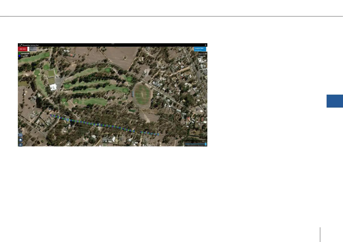
Mismatches Solving Tool:
In case there are mismatches between exposures and pictures please access “Solve Mismatches” in the “Job Summary (C)”.
B
A
C
D E
Flight Path (A)
The complete ight path and the corresponding geotags and images are directly displayed in the map.
Flight Summary (B)
A summary of total active
**
exposures detected in FlyLog and the total amount of images found in the directory are displayed
here. The data is updated based on the current selected payload, and the color indicates if there are mismatches detected for
the current payload (Red\Green).
Flight Leg Summary (C)
The images and exposures are split and grouped ight legs and only these with mismatches are displayed. In this section, the
QBase – Ground Control Station
7