USER MANUAL
INTEL® FALCON™ 8+ UAS
© 2018 Intel Corporation. All rights reserved 189
Images can later be processed with photogrammetry software as with any regular
preplanned mapping flight. More complex flights should be planned and performed
with the AscTec Navigator Software.
In the near future AscTec Navigator Software will be replaced by the advanced flight
planning software Intel Mission Control. For up to date information, please check:
http://www.intel.com/IntelMissionControl.
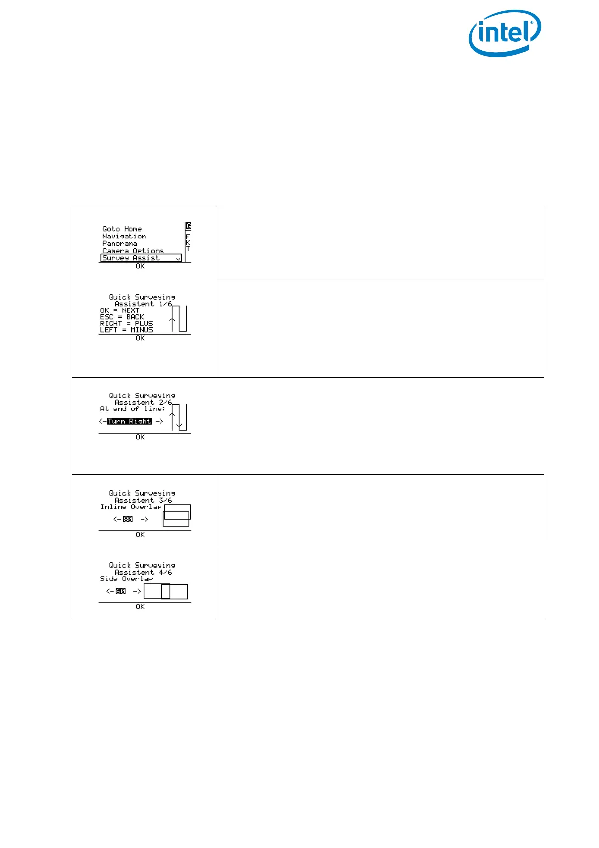
Figure 5.4: Quick Surveying Assistant
Pushing ENT in the Main Screen opens the screen to the
left.
Use the arrow RIGHT/LEFT button to select
Survey Assist and push ENT.
An introduction screen is opened, explaining the com-
mands to navigate the menu.
Pushing ENT opens the next screen.
Pushing ESC brings you back to the previous screen.
Use the arrow LEFT/RIGHT button to increase or
decrease values.
At the end of line: Define the direction in which
the Intel® Falcon™ 8+ UAV turns after completing the first
line of images.
Use the arrow RIGHT/LEFT button to select Turn
Right
or Turn Left and push ENT. The next screen
opens.
Inline Overlap: Define the percentage of image
overlap in the direction of flight (along track).
Side Overlap: Define the percentage of image overlap
between the lines (cross track).