USER MANUAL
INTEL® FALCON™ 8+ UAS
© 2018 Intel Corporation. All rights reserved 92
Using the Photo Tagger module in AscTec Navigator, it is possible to geo-reference the
images that were taken in-flight. Please see the AscTec Navigator Software Manual for
further details.
In the near future AscTec Navigator Software will be replaced by the advanced flight
planning software Intel Mission Control. For up to date information, please check:
http://www.intel.com/IntelMissionControl
It might happen that the Intel® Falcon™ 8+ UAV cannot access a logging storage device.
Usually, it is caused by a mechanical connection issue or a corrupted file system on the
storage device. If the Intel® Falcon™ 8+ UAV cannot access a storage device, a
respective warning will be displayed (see following).
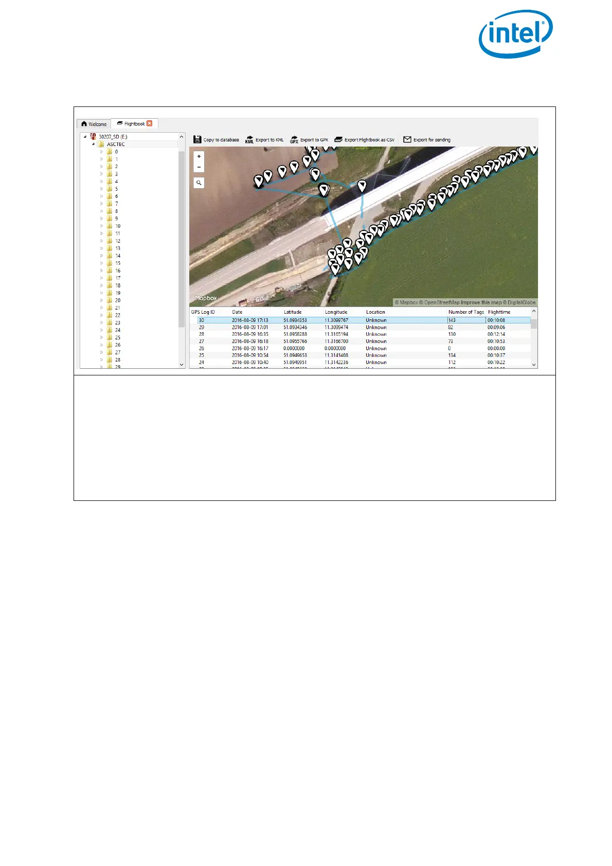
Figure 2.41: AscTec Navigator Software Flightbook
The map view shows the flight path and photo trigger positions, the list view under-
neath the map shows: the log ID (subsequent number), start time and date, the GPS
position (WGS84), the number of image tags (triggers) during the flight, and the flight
time. The buttons above the map view allow exporting a single flight as KML or GPX,
or an overview of all flights into a CSV file. It is also possible to export a log file as a
ZIP file to be able to send it by email.
Please see the chapter 5. Flightbook in the AscTec Navigator Software Manual for
further details. The manual can be found here: http://intel.com/FalconManual.