USER MANUAL
INTEL® FALCON™ 8+ UAS
© 2018 Intel Corporation. All rights reserved 191
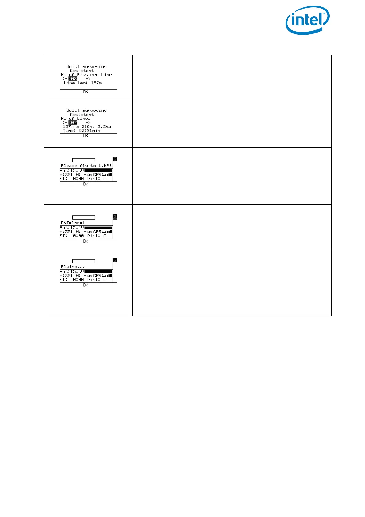
No of Pics per Line: Define the number of images
per line. The resulting length, which is covered by the
images is calculated and displayed (Line Len:) under-
neath the number of images.
No of Lines: Define the number of lines which shall be
flown. The resulting area, which will be covered by the
images, is calculated and displayed in ha (hectare). The
estimated required flight time to perform the flight is also
presented.
Please fly to 1.WP!: Fly the Intel® Falcon™ 8+ UAV
to the corner of the rectangle, where the mapping flight is
supposed to start with the first image. Adjust the heading
(yaw) of the system to define the direction of the flight.
Use the video preview as a help to precisely define the
direction.
ENT=Done!: When the system is at the right spot and
oriented correctly, confirm by pushing ENT. The Intel®
Falcon™ 8+ UAV will first fly to the calculated altitude and
then perform the mapping flight with the set parameters.
Flying...:During the flight a bar shows the progress.
At the end of the matrix the Intel® Falcon™ 8+ will stop
automatically. Push ESC to exit the screen and go back to
the main menu.
A Survey Assist flight can always be interrupted by giving
a strong control stick command on the CTR or by pushing
ESC.
Figure 5.4: Quick Surveying Assistant (Continued)