56
Trinity F90+ user manual
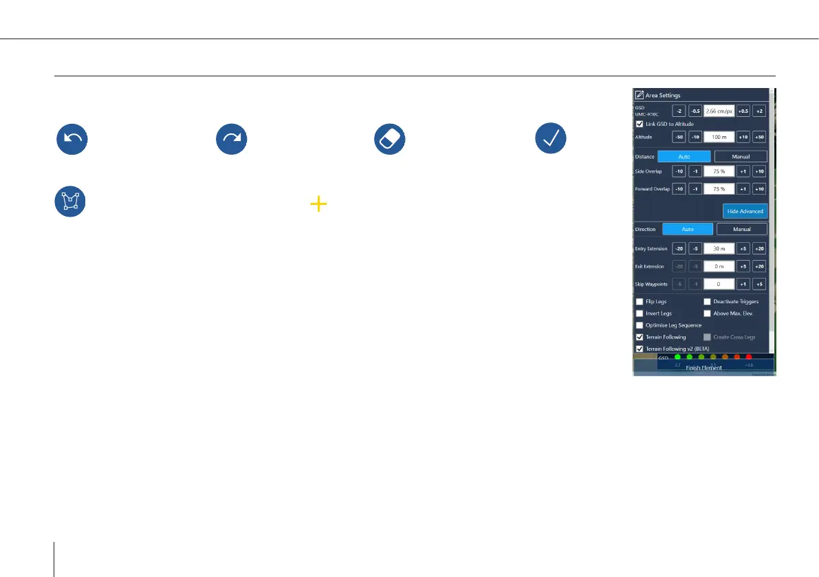
Planning a new area
Draw a new area according to chapter 7.3.
Undo the last change Redo the last change Delete selected point Finish
editing the geometry
Start/Stop adding points By selecting a new point between two existing points can be
added.
After planning the area the settings dialog appears. You can always edit the settings by selecting the
element on the left side or in the map.
GSD: The ground sample distance (distance on the ground between the mid of two pixels) is calcu-
lated based on the ight altitude and the camera properties for each camera. This value is linked to
the altitude.
Altitude: The ight altitude is dened as the altitude above ground.
Please do not exceed the maximum altitude that is allowed for your region. This value is linked to
the GSD.
Side and Forward Overlap: Overlap settings are dependent on the payload. Overlap default settings are based on the payload
settings.
Legs can be extended at the entry and the exit of the ight area. By default the legs at the entry are extended by 30 m to ensure
allignment of UAV and leg before starting to take pictures.
Skip Waypoints: Skip the selected amount of waypoints at the beginning of an area.
Flip Legs: Change the waypoint order of the area. While planning a PPK mission in QBase it is recommended to choose the