59
Trinity F90+ user manual
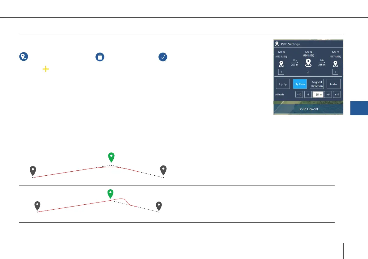
Path
Simple path: Specifying waypoints in order to y around obstacles or delay the ight by loitering.
Delete selected waypoint Delete all waypoints Finish editing the geometry
1. Select
on the map: add new waypoint between two existing waypoints
2. Setting dialog appears
3. Change settings in the element on the left side or in the map
Altitude
• Flight altitude: Altitude above ground.
• Do not exceed the maximum altitude that is allowed for your region.
Waypoint types
The selected waypoint is displayed in green.
Fly By
• The waypoint is not directly overown.
• The UAV turns before reaching the waypoint to smoothly
align with the next leg.
Fly Over
• The waypoint is directly overown.
• The UAV realigns with the next leg after the waypoint.
QBase – Ground Control Station
7