includes some energy that penetrates into the grass
,
soft
sand, or mud and
then reflects back to the transducer slightly delayed in time. Under some
conditions, the sonic energy is strong enough to penetrate the soft bottom
and show a harder sub-botton such as an oyster beds or ledges.
If the sea bottom is made up of coral beds, wrecks, or rock piles, the
irregular surfaces of the bottom structures provide a series of closely spaced
echo returns from the various angles of the bottom. On screen, the bottom
line appears irregular with long tails as shown in the “Live Bottom”
figure.
Generally, these bottom conditions provide an ideal habitat for locating
fish.
On your display the echoes are printed on the CRT screen beginning at
the right edge adjacent to the range scale marks. Each time the echo
sounder transmits and receives, the new echoes replace the old echoes at
the right edge and the picture is
shifted
to the left. You can see the received
echoes even more clearly when you turn on the A-Scope feature of the
V8010.
Eventually
a
historical
picture of the bottom contour
and
fish echoes
that you have passed over
lYll
the screen.
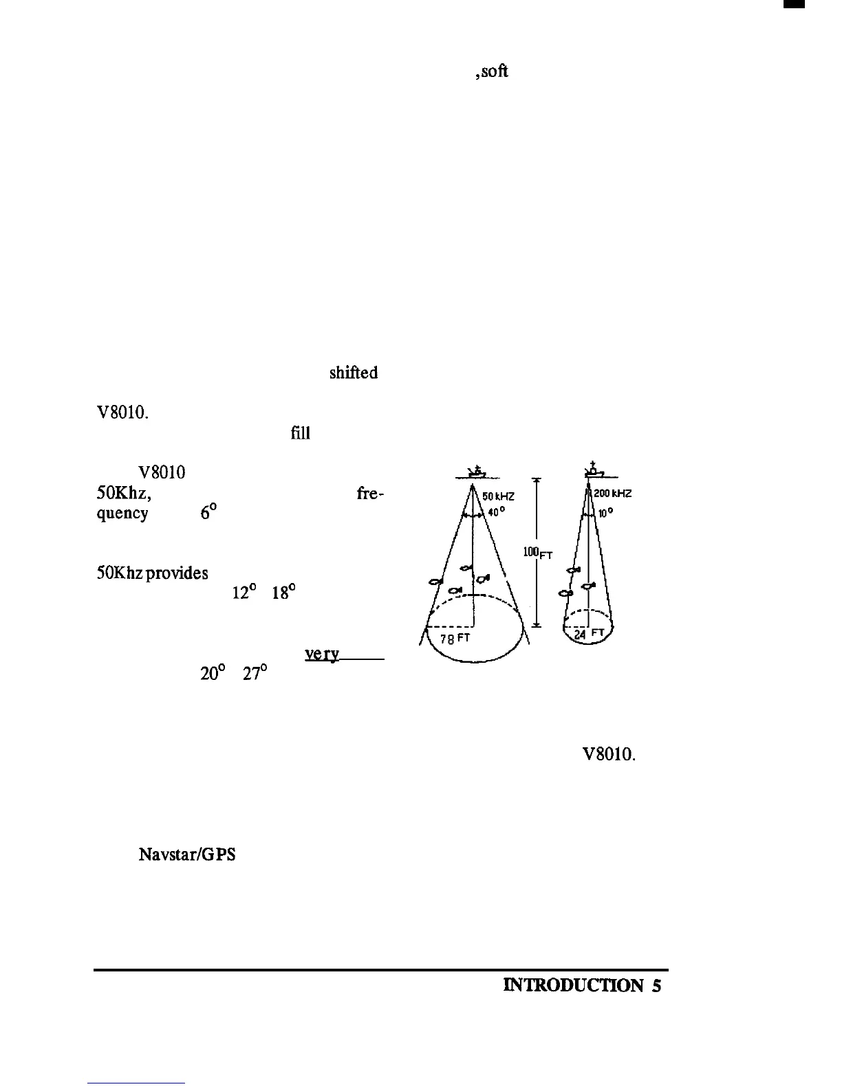
The
V8010
operates at either 200 Khz,
SOKhz,
or 28Khz. The 200 Khz fre-
quency
uses a
6O
beam angle to provide
excellent detection of small fish and
high resolution of bottom detail. The
SOKhzprovides
a larger fish search pat-
tern with its wider
12’
x
18’
beam angle
and deeper depth bottom tracking. The
28Khz frequency is best for fish search
and bottom detection in
very
deep
water using a 20’ x
27’
beam.
The Operation section describes how the various controls can be set for
optimum performance. So, please take the time to read the Operation
section thoroughly so you can always get the best results from the
V8010.
1.4 GPS GENERAL INFORMATION
The Navstar/GPS system is a satellite-based radio navigation system de-
signed to provide global, continuous 24 hour-per-day all weather, accurate
position data for navigators worldwide.
KNTRODUCTION
5