352.15 Geodetic System (Data Corrections)
In preparing charts or maps, cartographers rely on a particular geodetic
datum or “scaling system” on which to calibrate the Latitude/Longitude
coordinate structure onto their charts. The type of datum used is normally
listed in the table information located on the chart.
In some locations, mariners can/may find considerable errors (up to 200
meters) in plotting own ship’s position
iftheir
charts were created using one
type of geodetic data system while the GPS navigator is busy calculating
positions using another data system. The
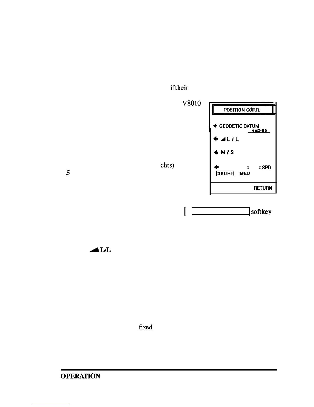
V8010
can be programmed to provide position calcula-
tions utilizing any of the following geodetic
datums:
1
WGS-84
( same as NAD 83, USA)
2
WGS-72 (Loran C)
3
BESSEL (for Japan)
4
NAD-27 USA (older NOAA
chts)
5
NAD -27 CAN (Canada/Alaska)
6
EUROPEAN 50 (for Europe)
7
AUSTRAL 66 (for Australia)
8
OSGB 36 (British Admiralty)
+
ALIL
N 00. 00’
w 00. 00”
4
NIS
+
RESPONSE
=
L/L
=
SPD
m
ME0 LONG
PRESS MENU TO
FIETURN
To change the Geodetic datum, press the
1
GEODETIC SYSTEM
1
softkey
repeatedly to scroll through the datum choices. When your selection is
displayed, it becomes the active datum for L/L calculations. The GPS
sensor normally uses WGS-84 (NAD-83).
352.1.6
AL/L
In some special cases you may wish to “calibrate” your GPS position data
to your navigation chart by manually adding a “fixed” offset value to your
L/L readouts.
A most common method of calibrating the GPS to a marine chart is to
locate your vessel next to a fixed, charted landmark and measure the exact
difference in Latitude and Longitude between the charted position of the
landmark and your GPS display
unit
readouts. Any difference shown on the
GPS readouts can then be
fixed
by adding or subtracting values manually
to produce corrected L/L coordinates on the GPS displayto match the chart.
OPFXATION
104
 Loading...