152
152
Other
Glossary
2D/3D GPS reception
The GPS receiver uses signals from satellites
to calculate its current position (the user's
position), but to acquire a 3D position at least
four signals are necessary, including altitude.
The GPS device may not be able to acquire
signals from four satellites as they are
constantly moving and obstacles may block
satellite signals. Although the accuracy
decreases when only three signals can be
acquired, and altitude data cannot be sent,
the receiver can calculate a latitude and
longitude GPS position. Only 2D reception is
possible.
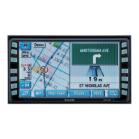
Route being navigated
The route currently being navigated. When a
destination is set, the route will be
continuously navigated until the destination is
deleted, you arrive at the destination, or the
software is closed. Also see “Route”.
City centre
The centre of the city/town is not the
geographical centre of the city/town, but a
location set by the cartographer. In towns and
villages, this is usually the most important
intersection, while in larger cities it is selected
from multiple important intersections.
Colour design
The colour design used for the map and
menu screens differs for daytime and
nighttime. Each design has a different
graphic setting, with 2D and 3D each having
colours for roads, blocks, seas, and lakes,
whilst shadow changes and shadows are
displayed differently in 3D mode.
Daytime screen and nighttime screen
designs for the map and menu are selected
one at a time. The design changes
automatically when day becomes night and
night becomes day.
GPS accuracy
Various factors can contribute to a margin of
error between the user's actual position and
the position acquired from the GPS device.
For example, signal delays in the ionosphere
or reflections from objects around the GPS
equipment, can influence the accuracy with
which the GPS device can calculate the
user's position.
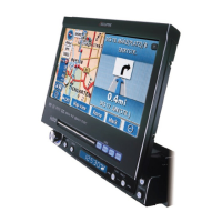
Maps
Although this software uses digital maps,
these are not simply digital conversions from
printed maps. The 2D mode digital map
represents roads in the same way as a
traditional printed map, using colour
classifications to show streets, roads, and
changes in altitude.
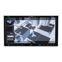
In 3D mode, you can confirm differences in
altitude for mountains, valleys, highland
roads and so on, and display areas of cities
using 3D landmarks and 3D images of
buildings.
The digital map can be used interactively.
You can zoom in and out (enlarge/reduce), tilt
up and down, and rotate left and right. By
using navigation that supports GPS, you can
easily plan your route with the digital maps.
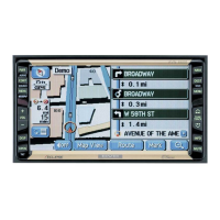
North Up Map Direction
North Up mode rotates the map so that North
is always at the top of the map. You can use
this direction with Find On Map and so on.
Also see “Heads-up Map Direction”.