297
297
To enhance your enjoyment of this product, please familiarise yourself with the following terms.
Glossary
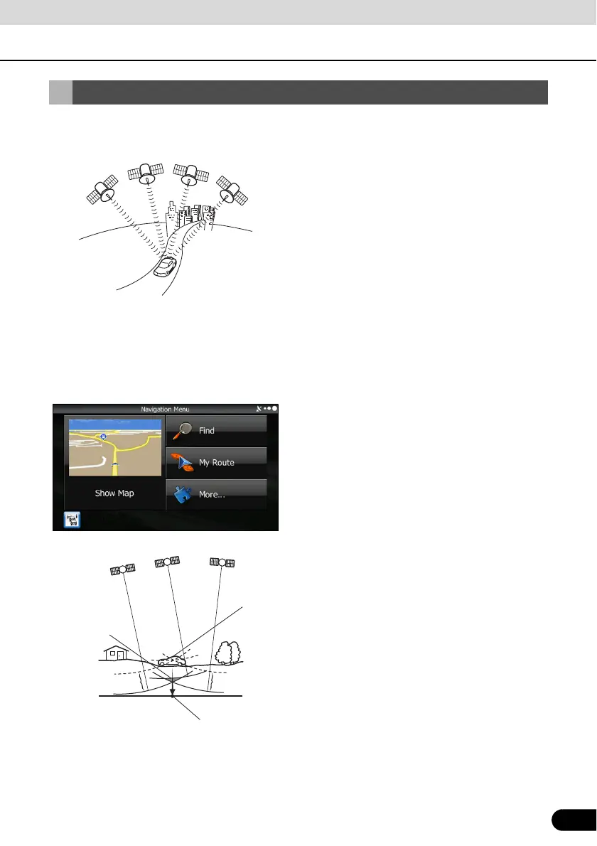
● GPS (Global Positioning System) GPS is a system that detects the current location
(latitude, longitude, altitude) by receiving radio waves
from 4 or more GPS satellites in normal situations, or
sometimes from 3 satellites.
These satellites are launched and managed by the US
Department of Defense mainly for military use, but they
are also open for private use. This unit performs
navigation using GPS information, various sensors, and
road map data.
● Wide area map, detailed map The wide area map is a map of a large area, and the
detailed map is a map of a small area. The scales of the
maps are 1/20,480,000, 1/10,240,000, 1/5,120,000,
1/ 2,560,000, 1/1,280,000, 1/640,000, 1/320,000,
1/160,000, 1/80,000, 1/40,000, 1/20,000, 1/10,000, and
1/5,000.
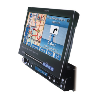
● Positioning The quality of the GPS positioning is displayed in the top
right of the menu screen. The greater the number of
displayed symbols, the higher the precision of the GPS
positioning.
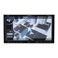
● 2D positioning and 3D positioning GPS calculates positions using triangulation.
The distance to the satellite can be determined when the
radio wave from that satellite is received, and the current
location can be measured by receiving radio waves from
3 satellites.
However, because there is a margin of error in the GPS
satellites and navigation unit, positioning is performed in
only the 2 dimensions of latitude and longitude when
radio waves from only 3 satellites can be received. The
precision will be lower in this case. When radio waves
from 4 or more GPS satellites are received, positioning is
performed in the 3 dimensions of latitude, longitude, and
altitude. 3D positioning is more precise than 2D
positioning, and it reduces the margin of error in the
vehicle location display.
Signals do
not intercross
at one point
Position determined by
2-dimensional measurement
Actual
position
Error