Applications Zoom20/30/35 Pro | 51
Messages The following are important messages or warnings that may appear.
Next step Press OK to return to the APPS menu.
11.5 Missing Line Measurement
Description Missing Line Measurement is an application used to compute slope distance, horizontal distance, height
difference and azimuth of two target points which are either measured, selected from the memory, or
entered using the keypad.
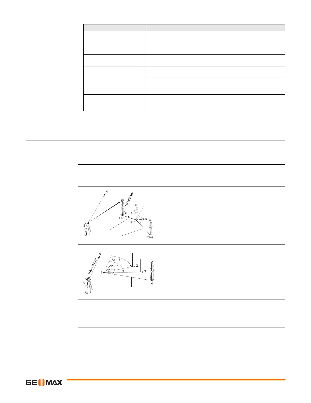
Missing Line Measure-
ment methods
The user can choose between two different methods:
• Polygonal: P1-P2, P2-P3, P3-P4.
• Radial: P1-P2, P1-P3, P1-P4.
Polygonal method
Radial method
Access 1) Select Apps from the MAIN MENU.
2) Select MLM from the Apps menu.
3) Complete application pre-settings. Refer to "10 Applications - Getting Started".
4) Select Polygonal or Radial.
Missing line measure-
ments
After completing the measurements required, the MLM RESULT screen will appear.
Messages Description
Selected point has no valid
data!
This message occurs if the selected target point has no Easting or
Northing coordinate.
Max 5 points supported! 5 points have already been measured and another point is selected. The
system supports a maximum of 5 points.
Invalid data - no position
computed!
The measurements may not allow final station coordinates (Eastings,
Northings) to be computed.
Invalid data - no height
computed!
Either the target height is invalid or insufficient measurements are avail-
able to compute a final station height.
Remeasure point in Face I
and II!
This error occurs if a point was measured in one face and the measure-
ment in the other face differs by more than 180° ± 0.9° for the hori-
zontal or vertical angle.
More points or distance
required!
There is insufficient data measured to be able to compute a position.
Either there are not enough points used or not enough distances meas-
ured.
T101 1st target point
T202 2nd target point
T303 3rd target point
SD 1-2 Slope distance from T101-T202
SD 2-3 Slope distance from T202-T303
Az 1-2 Azimuth from T101-T202
Az 2-3 Azimuth from T202-T303
SD 1-2
SD 2-3
1-4 Target points
SD 1-2 Slope distance from 1-2
SD 1-3 Slope distance from 1-3
SD 1-4 Slope distance from 1-4
Az 1-2 Azimuth from 1-2
Az 1-3 Azimuth from 1-3
Az 1-4 Azimuth from 1-4
CP Center point
CP
SD 1-2
SD 1-3
SD 1-4
 Loading...


