MapView Interactive Display Feature Zoom20/30/35 Pro | 41
9 MapView Interactive Display Feature
9.1 Overview
Availability Only available on Zoom30 Pro and Zoom35 Pro.
Description MapView is an display feature embedded in the firmware. MapView provides a graphical display of the
survey elements which allows for a better overall understanding of how the data being used and measured
relates to each other.
9.2 Accessing MapView
Description The MapView interactive display feature is provided as a page within applications. It is accessed through
the application itself. Depending on the application and from where in the application MapView is accessed,
different MapView modes are available.
Access To view points on a map:
•In R-SURVEY/SURVEY change to page 4/5.
•In Apps press the softkey MAP.
9.3 MapView Components
9.3.1 Screen Area
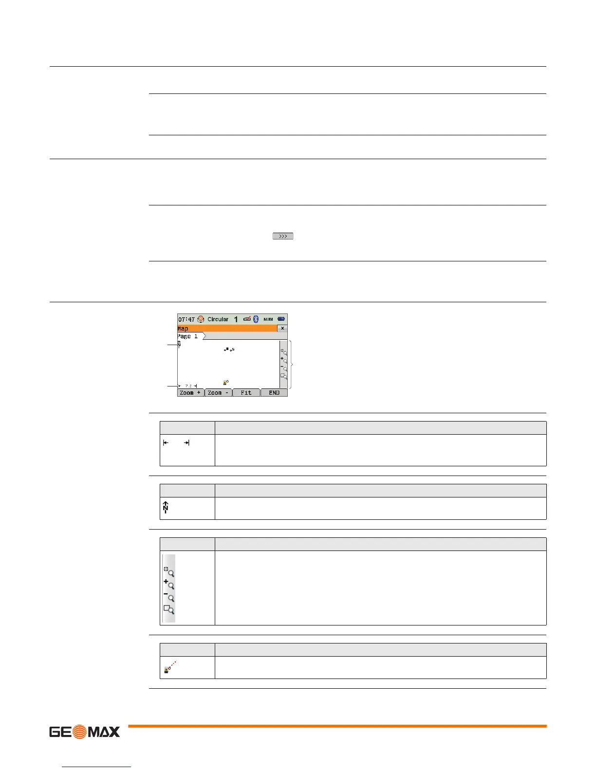
Standard screen
Scale bar
North arrow
Toolbar
Instrument station
a) North arrow
b) Scale bar
c) Toolbar
009225_001_en
a
b
c
Symbol Description
115
Scale of the current screen. The minimum is 0.1 m. There is no maximum for the zoom
but the scale cannot display values greater than 99000 m. In this case the value displayed
will be >99000 m.
Symbol Description
North arrow. North is always orientated towards the top of the screen.
Symbol Description
Icon toolbar. Refer to "9.3.2 Keys, Softkeys and Toolbar" for more information about the
functionality of the icons in the toolbar.
Symbol Description
Position of the instrument station. The orientation of the instrument is shown as dotted
line.

 Loading...


