Applications Zoom20/30/35 Pro | 63
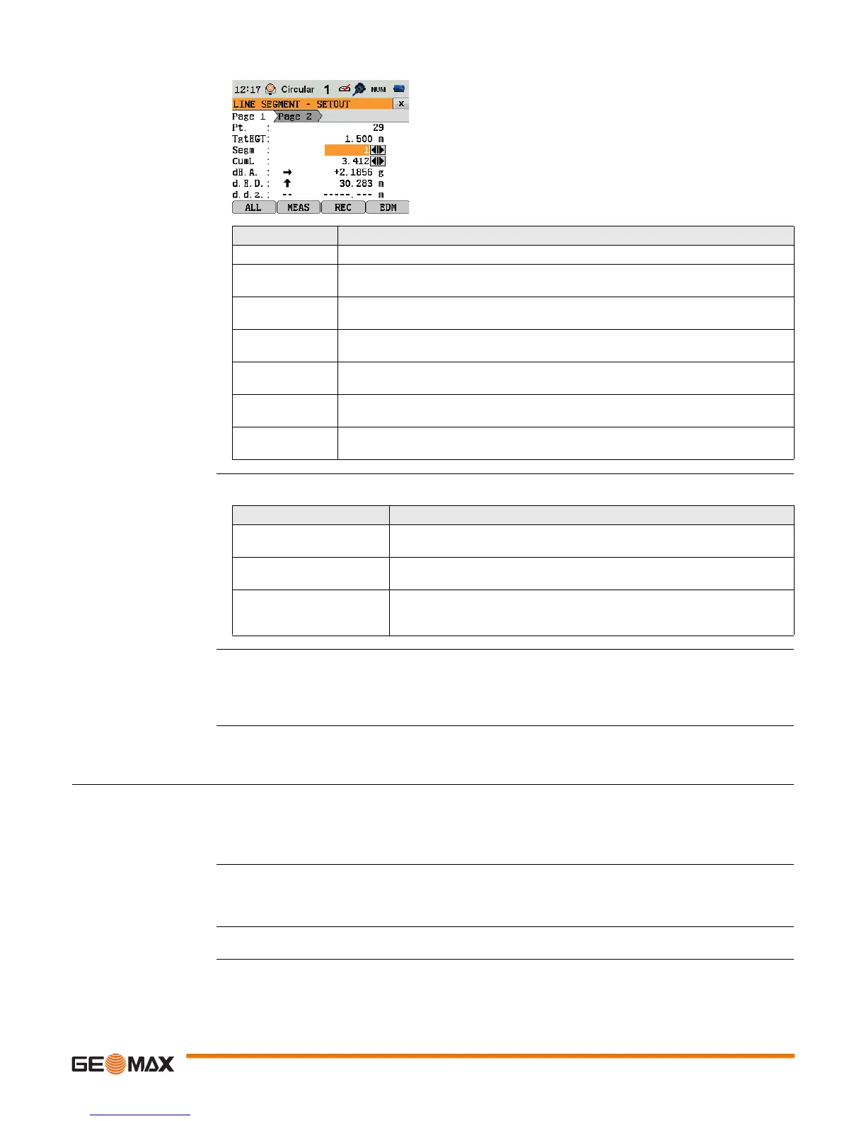
LINE SEGMENT -
SETOUT
The signs for the distance and angle differences are correction values (required minus actual). The arrows
indicate the direction to move to get to the setout point.
Messages The following are important messages or warnings that may appear.
Next step • Either, press ALL to measure and record.
• Or, press ESC to return to the Define Line Segment screen and from there, press BACK to return to
REFERENCE LINE screen.
• Or, continue selecting ESC to exit the application.
11.10 Reference Element - Reference Arc
11.10.1 Overview
Description The Reference Element - Arc application allows the user to define a reference arc and then complete the
following tasks with respect to the arc:
• Line & offset
• Set out (Point, Arc, Chord, Angle)
Access 1) Select Apps from the MAIN MENU.
2) Select R_ARC from the Apps menu.
3) Complete application pre-settings. Refer to "10 Applications - Getting Started".
Next step Define the reference arc.
Field Description
Segm Segment number. Includes the misclosure segment, if applicable.
CumL Cumulation of the segment lengths. Changes with the current number of segments.
Includes the misclosure segment length if applicable.
dH.A. Horizontal direction from the measured point to the setout point. Positive if the tele-
scope must be turned clockwise to the setout point.
d.H.D. Horizontal distance from the measured point to the setout point. Positive if the setout
point is further away than the measured point.
d.d.z. Height difference from the measured point to the setout point. Positive if the setout
point is higher than the measured point.
dL Longitudinal distance from the measured point to the setout point. Positive if setout
point is further away than the measured point.
dO Perpendicular distance from the measured point to the setout point. Positive if setout
point is to the right of the measured point.
Messages Description
Baseline too short! Base line is shorter than 1 cm. Choose base points such that the horizontal
separation of both points is at least 1 cm.
Coordinates invalid! No coordinates or invalid coordinates for a point. Ensure that points used
have at least Easting and Northing coordinates.
Recording to interface! Data Output is set to Interface in the GENERAL SETTINGS menu. To be
able to successfully start reference line, Data Output must be set to Int.
Memory.
 Loading...


