Zoom20/30/35 Pro | 60Applications
Next step
Press OK to proceed to measurement mode.
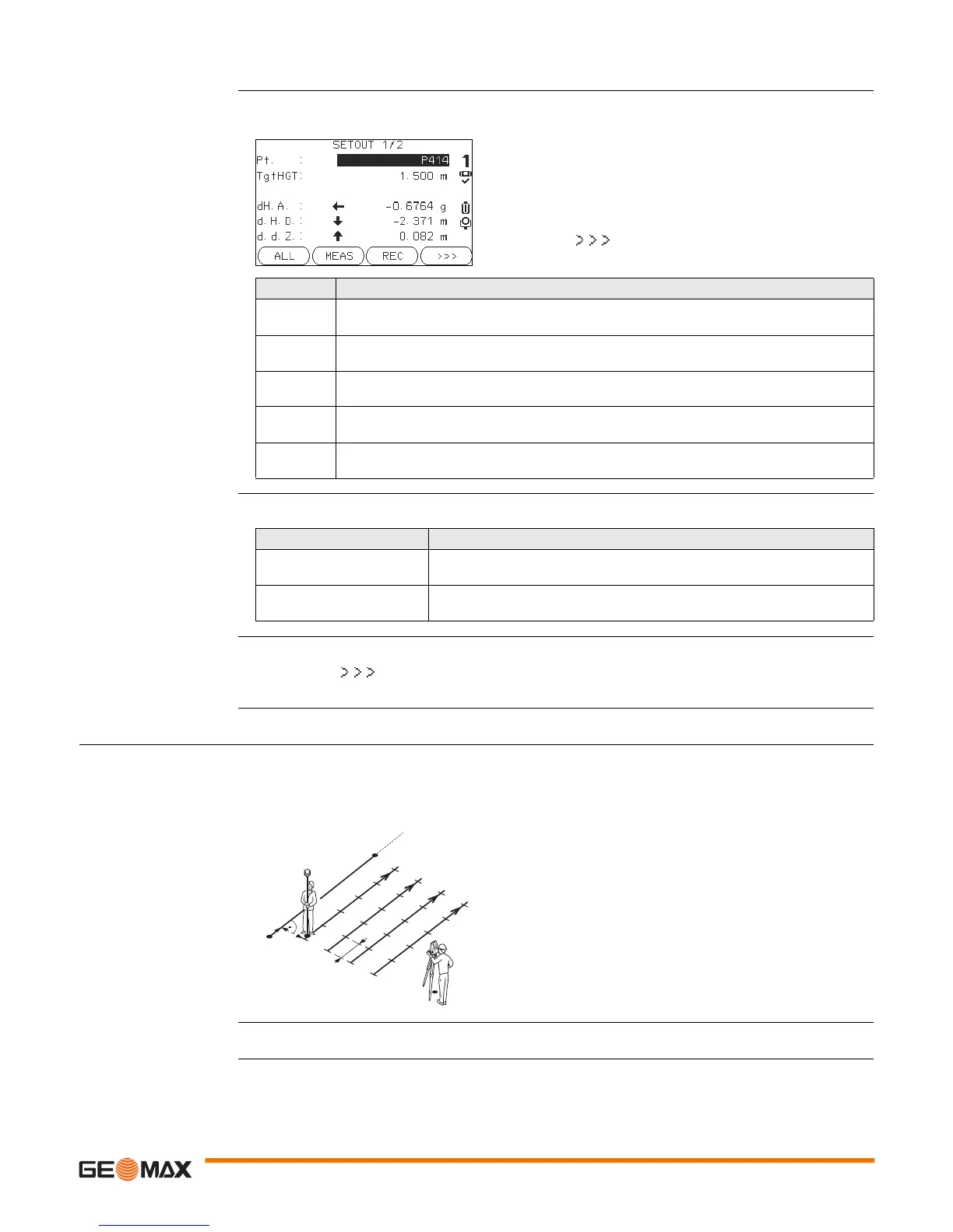
SET OUT The signs for the distance and angle differences are correction values (required minus actual). The arrows
indicate the direction to move to get to the set out point.
Messages The following are important messages or warnings that may appear.
Next step • Either, press ALL to measure and record.
• Or, press BACK to return to the REFERENCE LINE screen.
• Or, continue selecting ESC to exit the application.
11.9.6 Grid Setout
Description The Grid subprogram calculates and displays the stake out elements for the points on the grid, orthogonal
(dL, dO, dH) and polar (dH.A., d.H.D., d.d.z.). The grid is defined without boundaries. It can be extended
over the first and second base points of the reference line.
Example Grid Setout
Access Press Grid from the REFERENCE LINE screen.
NextPt
To add the next point to be set out.
Field Description
d HA Horizontal direction from the measured point to the set out point. Positive if the telescope
must be turned clockwise to the set out point.
d.H.D Horizontal distance from the measured point to the set out point. Positive if the set out point
is further away than the measured point.
d.d.Z Height difference from the measured point to the set out point. Positive if the set out point
is higher than the measured point.
dOffset Perpendicular distance from the measured point to the set out point. Positive if the set out
point is to the right of the measured point.
dLine Longitudinal distance from the measured point to the set out point. Positive if the set out
point is further away than the measured point.
Messages Description
Base line too short ! Base line is shorter than 1 cm. Choose base points such that the horizontal
separation of both points is at least 1 cm.
Coordinates invalid ! No coordinates or invalid coordinates for a point. Ensure that points used
have at least Easting and Northing coordinates.
a Reference line
P0 Instrument station
P1 Start point
P2 End point
d1 Start distance
d2 Increment
d3 Line offset
TSOX_039
P1
P2
d1
a
d2
d3
P0
 Loading...


