Zoom20/30/35 Pro | 68Applications
11.12 Road 2D
Description Road Alignment is an application used to measure or set out points relative to a defined element. The
element can be a line, curve or spiral. Chainage, incremental set outs and offsets (left and right) are
supported.
Access 1) Select Apps from the MAIN MENU.
2) Select Road 2D from the Apps menu.
3) Complete application pre-settings.
4) Select the element type:
Elements
Define the element
step-by-step
P0 Center point
P1 Start point of arc
P2 End point of arc
P3 Point to set out
a Anti-clockwise
b Clockwise
c+ Distance from start of arc, following curve
d- Perpendicular offset from arc
r Radius of arc
P0
P1
r
c+
b
a
P3
d-
P2
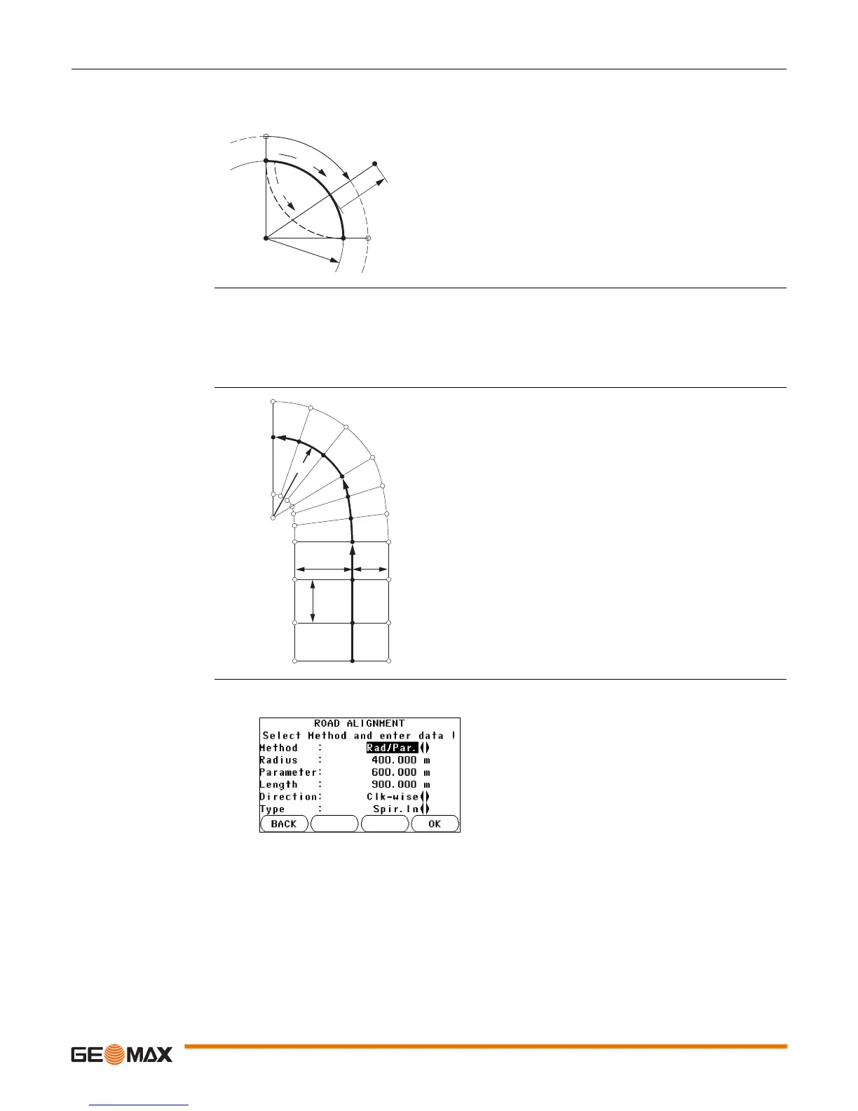
• Line • Curve • Spiral
AStraight
BSpiral
CCurve
RRadius
a Perpendicular offset left
b Perpendicular offset right
c Increment
dStationing
A
B
C
a
c
b
R
d = 112.000
d = 122.000
d = 132.000
d = 155.000
d = 102.000
1. Enter, measure or select from memory the start and end points.
2. For curve and spiral elements the ROAD screen for defining the element appears.
3. For a curve element: • Enter the radius and curve direction.
• Press OK.
 Loading...


