MAINTENANCE MANUAL
INTEL
®
FALCON™ 8+ UAS
DESCRIPTION
94 © 2017 Intel Corporation. All rights reserved.
REV 00
APR 2017
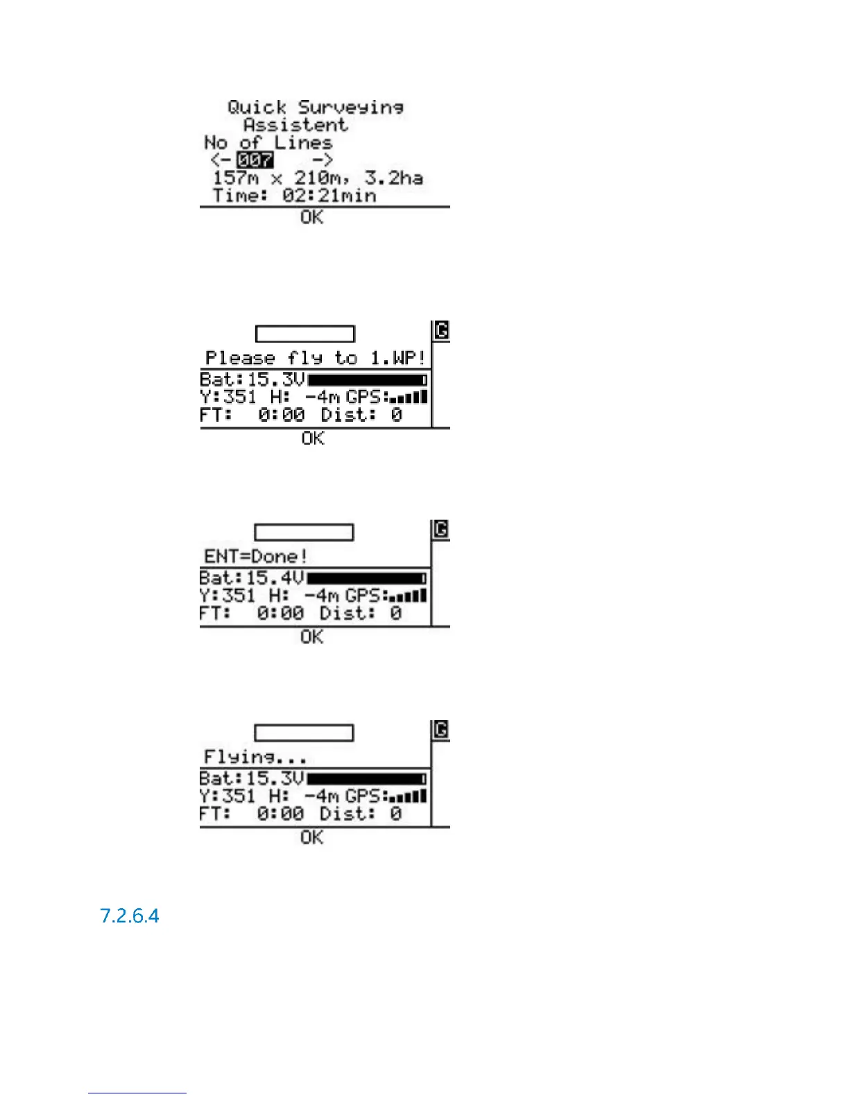
Please fly to 1.WP!: Fly the Intel
®
Falcon™ 8+ UAS to the corner of the rectangle, where
the mapping flight is supposed to start with the first image. Adjust the heading (yaw) of
the system to define the direction of the flight. Use the video preview as a help to
precisely define the direction.
ENT=Done!: When the system is at the right spot and oriented correctly, confirm by
pushing ENT. The Intel
®
Falcon™ 8+ UAS will first fly to the calculated altitude and then
perform the mapping flight with the set parameters.
Flying... During the flight a bar shows the progress. At the end of the matrix Intel
®
Falcon™
8+ UAS will stop automatically. Push ESC to exit the screen and go back to the main
menu.
A Survey Assist flight can always be interrupted by giving a strong control stick
command on the Intel
®
Cockpit GCS or by pushing ESC.
Waypoint Navigation Using AscTec Navigator Software
The AscTec Navigator Software enables planning and performing complex flight patterns for
remote surveying applications. Pre-planned AscTec Navigator Software flight missions are
exported to an USB stick, which is plugged into one of the USB ports of the Intel
®
Cockpit GCS.