DESCRIPTION
© 2017 Intel Corporation. All rights reserved. 93
REV 00
APR 2017
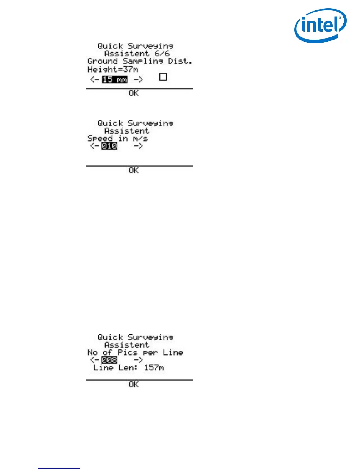
Speed in m/s: Define the speed with which the mapping flight shall be performed (1 m/s
– 10 m/s).
When setting the speed, always make sure that the camera has sufficient time in
between waypoints. The time required by the camera to reliably trigger and store all
images of a waypoint flight, depends on:
Image resolution: The higher the resolution, the more data has to be processed and
stored.
File format and image quality: RAW images contain the most information and are the
largest files, high quality settings will need more time during JPEG compression and
more space to store.
Writing speed of the SD card: If the card is too slow, this will slow down the saving
process.
Image content: Motives with complex structures (i.e. meadows, forest) will need more
time and space during JPEG compression than plain and simple motives (i.e. roads, flat
unstructured surfaces).
No of Pics per Line: Define the number of images per line. The resulting length, which is
covered by the images is calculated and displayed (Line Len:) underneath the number of
images.
No of Lines: Define the number of lines which shall be flown. The resulting area, which
will be covered by the images, is calculated and displayed in ha (hectare). The estimated
required flight time to perform the flight is also presented.