DESCRIPTION
© 2017 Intel Corporation. All rights reserved. 91
REV 00
APR 2017
Quick Surveying Assistant
This function is available as part of the Survey Package. Survey Assist offers a quick and easy
way to do a mapping flight over a rectangular area, directly from the Intel
®
Cockpit GCS without
any prior planning on a computer. To do so, the Intel
®
Falcon™ 8+ UAS is placed in one corner
of the area to be mapped, and the key parameters are entered: attached camera / lens
combination, desired ground sample distance, image overlaps, length of the lines and number
of lines. With this data, the resulting flying altitude and flight path is calculated and carried out.
An assistant guides the user through all required steps.
Images can later be processed with photogrammetry software as with any regular preplanned
mapping flight. More complex flights should be planned and performed with the AscTec
Navigator Software.
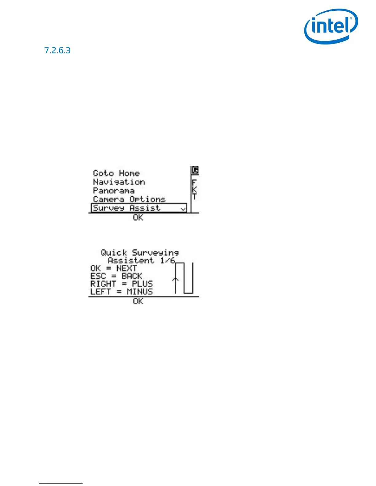
Pushing ENT in the Main Screen opens the screen below
Use the arrow RIGHT/LEFT button to select Survey Assist and push ENT.
An introduction screen is opened, explaining the commands to navigate the menu.
o Pushing ENT opens the next screen.
o Pushing ESC brings you back to the previous screen.
o Use the arrow LEFT/RIGHT button to increase or decrease values.
At the end of line: Define the direction in which the Intel
®
Falcon™ 8+ UAS turns after
completing the first line of images.
Use the arrow RIGHT/LEFT button to select Turn Right or Turn Left and push ENT. The
next screen opens.