USER MANUAL
INTEL® FALCON™ 8+ UAS
© 2018 Intel Corporation. All rights reserved 104
It is possible to store and edit individual waypoints (GPS position, height, camera
heading, and camera pitch angle) onto a USB stick, which is inserted into the CTR. A
waypoint can later be recalled, and the Intel® Falcon™ 8+ UAV will fly to this position
and take an image with the stored heading and pitch angle. Camera settings such as
shooting mode, or zoom, cannot be stored, and must be set manually before flight.
Multiple waypoints can be combined to create a path.
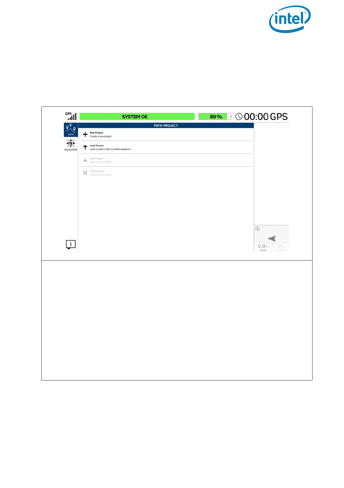
Figure 3.4: The Cockpit Control Application and PATH Projects
PATH PROJECT
Tapping on the PATH button in the main screen opens the window PATH PROJECT.
Here you can create, save, and load individual Paths projects (including the GPS posi-
tion, height, camera heading, and camera pitch angle).
Executing the PATH function via the touchscreen tablet:
Tapping on New Project opens the window PATH PROJECT - NEW with an
integrated keyboard (see below)
Tapping on Load Project opens a window in which you can load an already
stored PATH project from a USB stick, which is inserted into the CTR.
Save project: This button becomes active after creating a new, or modifying, a
new or existing project. Tap on this button to save the actual PATH project to the
inserted USB stick.
Close project: Tap here to close the actual PATH project.