USER MANUAL
INTEL® FALCON™ 8+ UAS
© 2018 Intel Corporation. All rights reserved 179
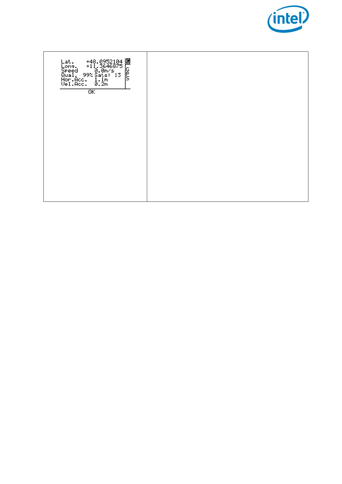
GPS Info Screen
Displays details regarding the GNSS reception
quality.
Lat. = Latitude of the UAV position.
G = Flight Mode. This is the same information as
on the Main Screen.
Long. = Longitude of the UAV position.
Speed = GPS measured flight speed of the UAV.
Qual.= Satellite reception quality.
Sats: = Number of satellites which can be
received.
Hor.Acc. = Horizontal accuracy in meters (m).
Vel.Acc. = Velocity accuracy in meters per sec-
ond (m/s).
OK = Status line. This is the same information as
on the Main Screen.
Figure 4.2: Main Information Screens (Continued)