Section 3 - Screen Overview and Operation
90-8M0070299 eng MAY 2012 Page 39
Environment and Navigation
Screen Display
Name
Description Screen
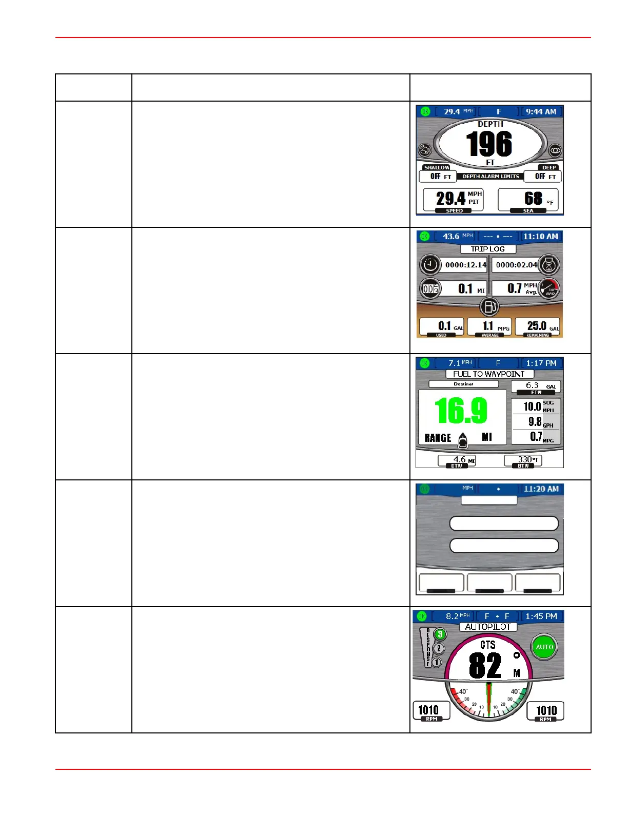
Depth
Displays water depth, speed through the available sensor, water
temperature. Also allows the operator to change the depth alarm
limits.
Trip Log
Displays total trip time, average speed, distance, and fuel usage
data.
Fuel to
Waypoint
Displays fuel usage data to a specified waypoint.
Navigation
Displays the exact location of the vessel, distance to waypoint,
speed over ground, and navigation heading.
LAT
LON
DIST WPT
SOG
HEADING
1.5
10.0 23
MI
MPH
T
O
NAVIGATION
20 20.328 S
157 44.502 W
o
o
27335
Autopilot
Displays the response level, vessel compass direction, drive
location, and engine RPM.
NOTE: This display feature is only available with Zeus
applications.