The row labeled ELEV indicates the satellite’s elevation angle above the
horizon. Generally, good elevation angles required for getting position
fixes are those greater than
5O
above the horizon.
The bottom
rowLEV%I,indicates
the strength
ofthe
satellite signalor SNR.
Lie
Loran-C, the stronger the signal level, the more accurate the position
lixis
likelyto be. The Raystar considers both the signal strength and satellite
geometry (HDOP) when making choices on the best satellites to track at
any particular time.
In the middle of the status display are a pair of larger boxes. The outermost
box, labeled
ALL
, shows the total number of satellites currently active in the
GPS system. This number may vary as GPS satellites continue to be
launched, activated, or de-activated during the year as the system testing
program of the satellites randomly continues by the USAF. However the
system number is expected to end up at 21.
The box labeled HDOP shows the Horizontal Dilution of Precision ratio
number. HDOP is simply a measure of the expected position lix accuracy
from the satellites being tracked.
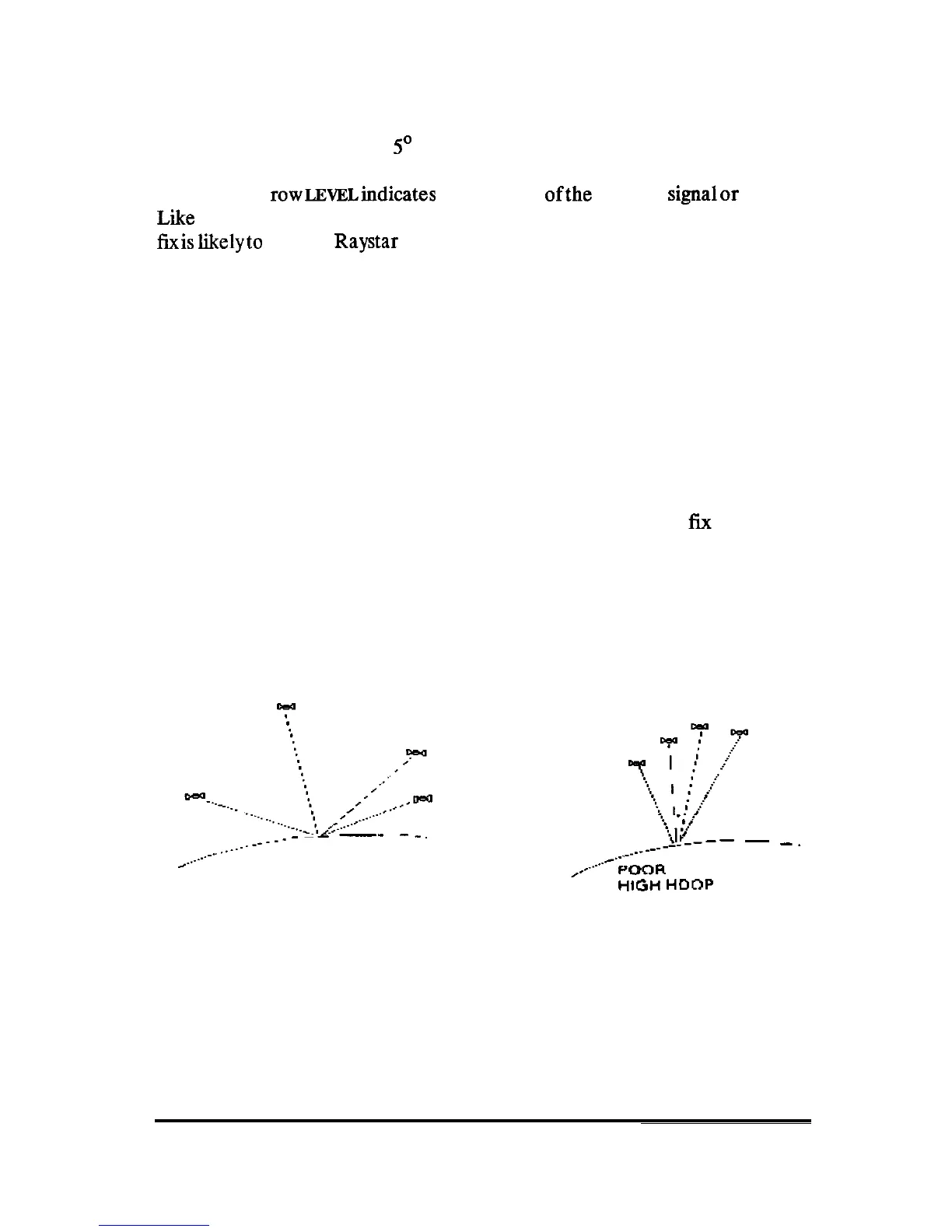
The HDOP is based on the geometry of the satellite positions relative to
your GPS antenna. If the satellites are spread widely apart from each other
the calculated position fix obtained is usually very accurate. This is consid-
ered “good” geometry and the HDOP number will be very small.
__/~
,,___..-----
-
--
-_.
GOOD GEOMETRY
LOW HDOP
i
.
f
$[___
-
_,
____--
A-“-
_..~
POOR
GEOMETRY
I-IIGH
HDnP
Conversely, if the satellites are bunched (close) together, the geometry
will be poor, the position fix will likely contain more error, and the HDOP
number value will be higher.
OPERATION
101



 To Next Page