153
• When [LOAD] is pressed,
registered coordinates can be recalled and used.
"13.1 Entering Instrument Station Data and Azimuth Angle
PROCEDURE Reading in Registered Coordinate Data"
• [REC]: records the coordinate
value as a known point data.
•Press [MEAS] to observe the
selected point.
• The tilt screen is displayed if the
instrument is out of level.
Level the instrument.
"7.2 Levelling"
3. Enter the 2nd point data and press
[OK].
•Press [MEAS] to observe the
selected point.
4. Enter azimuth angle (or horizontal
distance) of the 1st point and 2nd
point.
:
Both the azimuth angle and
horizontal distance of the 1st (or
2nd) point cannot be input.
• When the cursor is on "Azmth1"
or "Azmth2", [COORD] is
displayed. Press [COORD] to
set the azimuth angle for each
point by inputting coordinates.
•Press [MEAS] to observe the
selected point.
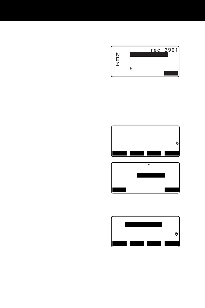
Define 2nd PT
Ep:
Np:
Zp:
112.706
104.069
11.775
RECLOAD MEAS OK
: 50.000m
Azmth1
H.dist1
Azmth2
H.dist2
: <Null>
:
: 45 00’00"
COORD
OK
1st PT
Ep:
Np:
Zp:
0.000
0.000
<Null>
RECLOAD MEAS NEXT