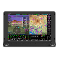
SV-ADAHRS-20X Installation and Configuration
SkyView System Installation Guide - Revision K 6-3
Obstacles data: Available for free for US customers from Dynon. Jeppesen and
PocketFMS data available for all other customers worldwide.
Basemap and Cultural Data: Database is available for free for all customers from Dynon.
Viewing Information about Installed Databases
The Installed Databases Page (SETUP MENU > LOCAL DISPLAY SETUP > INSTALLED DATABASES)
allows users to see the databases installed on their equipment as well as their respective
versions and expiration dates. The sections below outline the various databases that are
installed in SkyView.
Terrain Data
SkyView uses high resolution terrain data to display the base topographic map on the MAP
page, as well as to display Synthetic Vision on the PFD page. SV-D1000s and SV-D700s ship
preloaded with terrain data for North America (includes the continental United States, part of
Alaska, most of Canada, Mexico, part of Central America, and the West Indies). Dynon offers
downloadable high resolution terrain data files for other regions of the world on its website at
www.dynonavionics.com/docs/terrain.html.
To update the terrain data in a SkyView display, download the appropriate file onto a USB flash
drive (a 4 GB drive is included with every SkyView display) and then reference the How to Load
and Delete Files Section of this guide for instructions on how to import the file onto a SkyView
display. Because the terrain databases are large, only one can be installed in a SkyView display
at a time. A large USB memory stick can hold multiple terrain databases for different regions of
the world. However, each region’s coverage area is chosen to cover most pilots’ needs without
having to ever switch between regions. Loading a new high resolution terrain database will
automatically delete the one previously installed on your SkyView display.
Aviation/Obstacle Databases
Aviation and obstacle databases are used to display airports, runways, nav aids, airspace,
obstacles, and other aviation data on the moving map. It also makes allows SkyView to provide
detailed information about aviation features. SkyView can also provide navigation to these
aviation features.
US Customers – Obtaining Free Dynon Data
Aviation and Obstacle data is available free-of-charge for US customers. Go to
downloads.dynonavionics.com to download these databases to a USB memory stick. Reference
the Loading Databases section of this guide below for instructions on how to import the file
onto a SkyView display. Aviation data is updated every 28 days. Obstacle data is updated every
56 days.