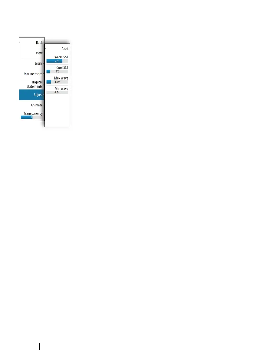
Adjusting color codes
You can define the sea surface temperature range and wave height
color coding.
The temperature above warm and below cool values is displayed as
progressively darker red and darker blue.
Waves higher than the maximum value are indicated with
progressively darker red. Waves lower than the minimum value are
not color coded.
Animating Sirius weather graphics
The GO XSE records the weather information you have turned on,
and this information can be used to animate past or future weather
conditions. The amount of information available in the system
depends on the amount of weather activity; the more complex it is,
the less time that is available for animation.
You can animate the past or the future, depending on which
weather view you have turned on:
• With precipitation overlay, you can animate for the past and only
assume weather conditions in the immediate future.
• With colored wave height overlay, you can animate the future
(the predictions).
When activated, the time for the current graphic animation is
displayed in the lower left corner of the chart panel.
178
Weather | GO XSE Operator Manual