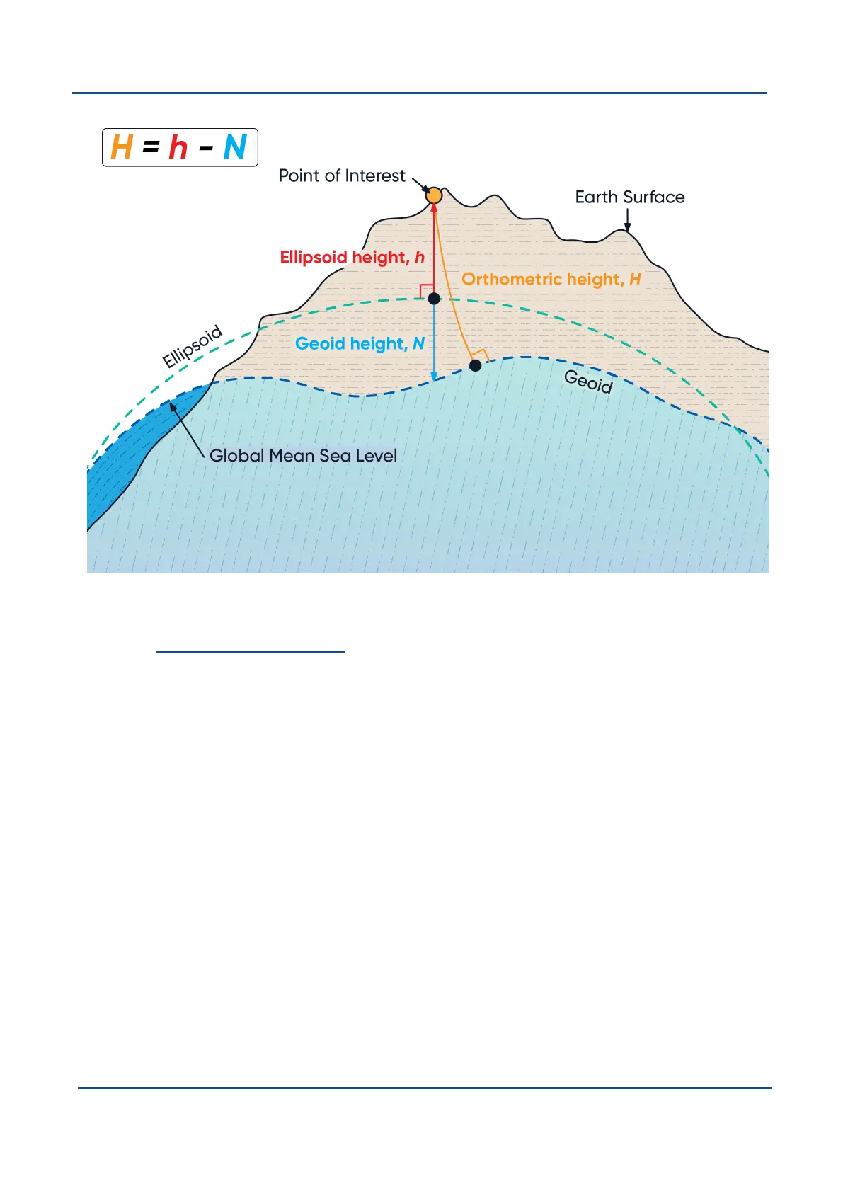
Figure 82: Orthometric, ellipsoid and geoid height diagram
The value required to convert the WGS84 ellipsoid height to orthometric height can be found in the geoid height
packet, see 11.4.33 Geoid Height Packet.
12.6 NED Co-ordinate Frame
The NED (North East Down) co-ordinate frame is used to express velocities and relative positions. The origin of
the co-ordinate frame is the current position. From that origin, the north axis points true north and parallel to the
line of latitude at that point. The east axis points perpendicular to the north axis and parallel to the line of
longitude at that point. The down axis points directly down towards the centre of the Earth. See the figure below
for a graphical representation of the NED co-ordinate frame at a position on the Earth.
v1.2 Page 183 11 Oct 2022
Boreas Reference Manual • Boreas Reference Information