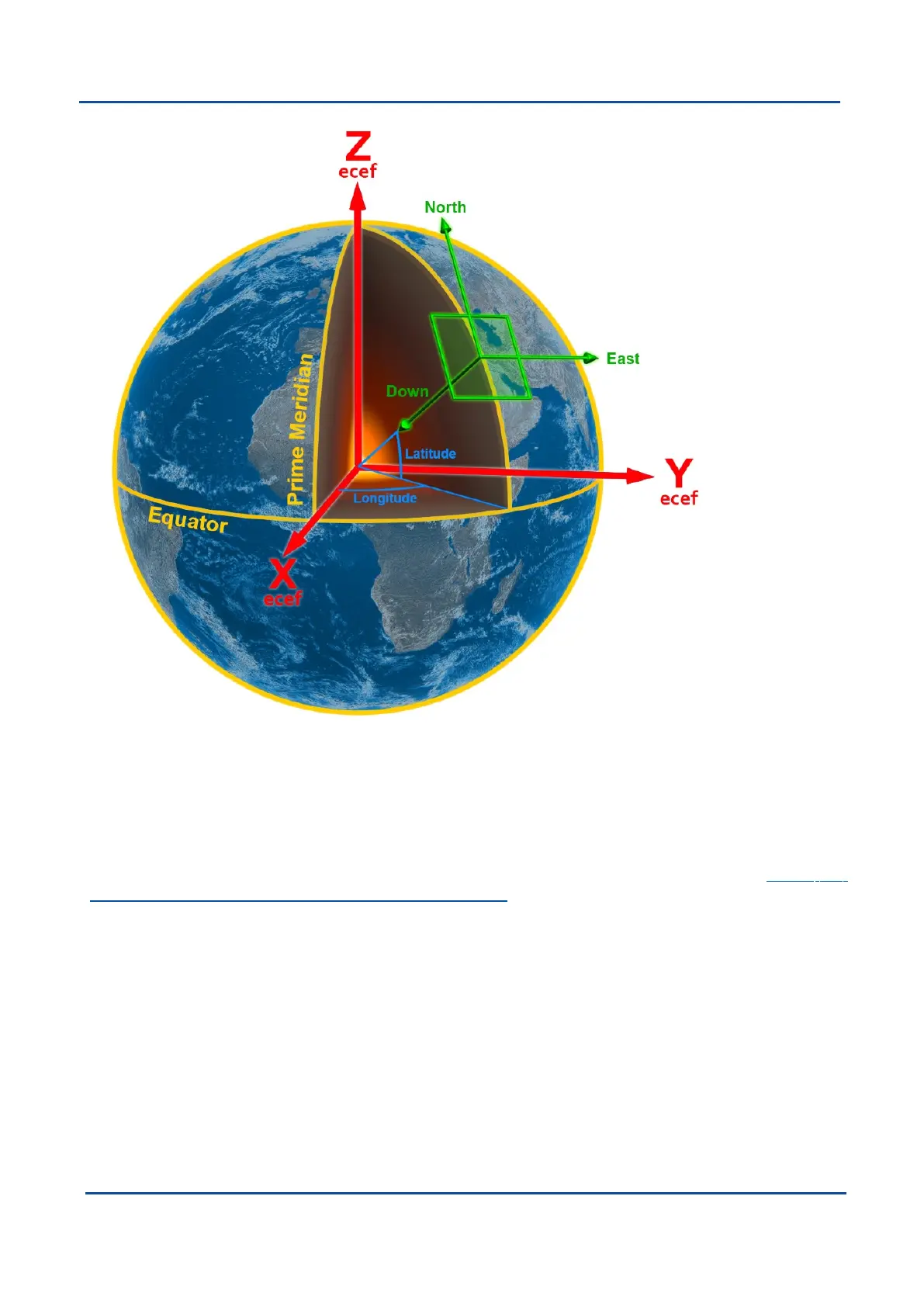
Figure 83: Graphic Showing Geodetic, NED and ECEF Co-ordinates
12.7 ECEF Co-ordinate Frame
The ECEF (Earth-centred earth-fixed) co-ordinate frame is a Cartesian co-ordinate frame used to represent
absolute positions on the Earth. Its origin is at the centre of the Earth. ECEF is an alternative to the geodetic co-
ordinate frame. It is represented by the three axes X, Y and Z which are presented graphically in Figure 83:
Graphic Showing Geodetic, NED and ECEF Co-ordinates. ECEF positions can be retrieved from Advanced
Navigation products, however the geodetic system is used as the default.
v1.2 Page 184 11 Oct 2022
Boreas Reference Manual • Boreas Reference Information


 To Previous Page