SmartROC D65 T4F 10 Options
180 No: 713944459.6 en
n Bit Pos Northing: Northerly coordinate in metres for Drill bit.
n Bit Pos Easting: Easterly coordinate in metres for Drill bit.
n Bit Pos Height: Elliptic height in metres for Drill bit.
n Rig Heading: Rig compass direction in degrees, positive direction clockwise, north-
erly direction is zero.
n Calc Baseline: Calculated baseline / (distance) between Master GPS receiver and
Slave GPS receiver Antenna in metres.
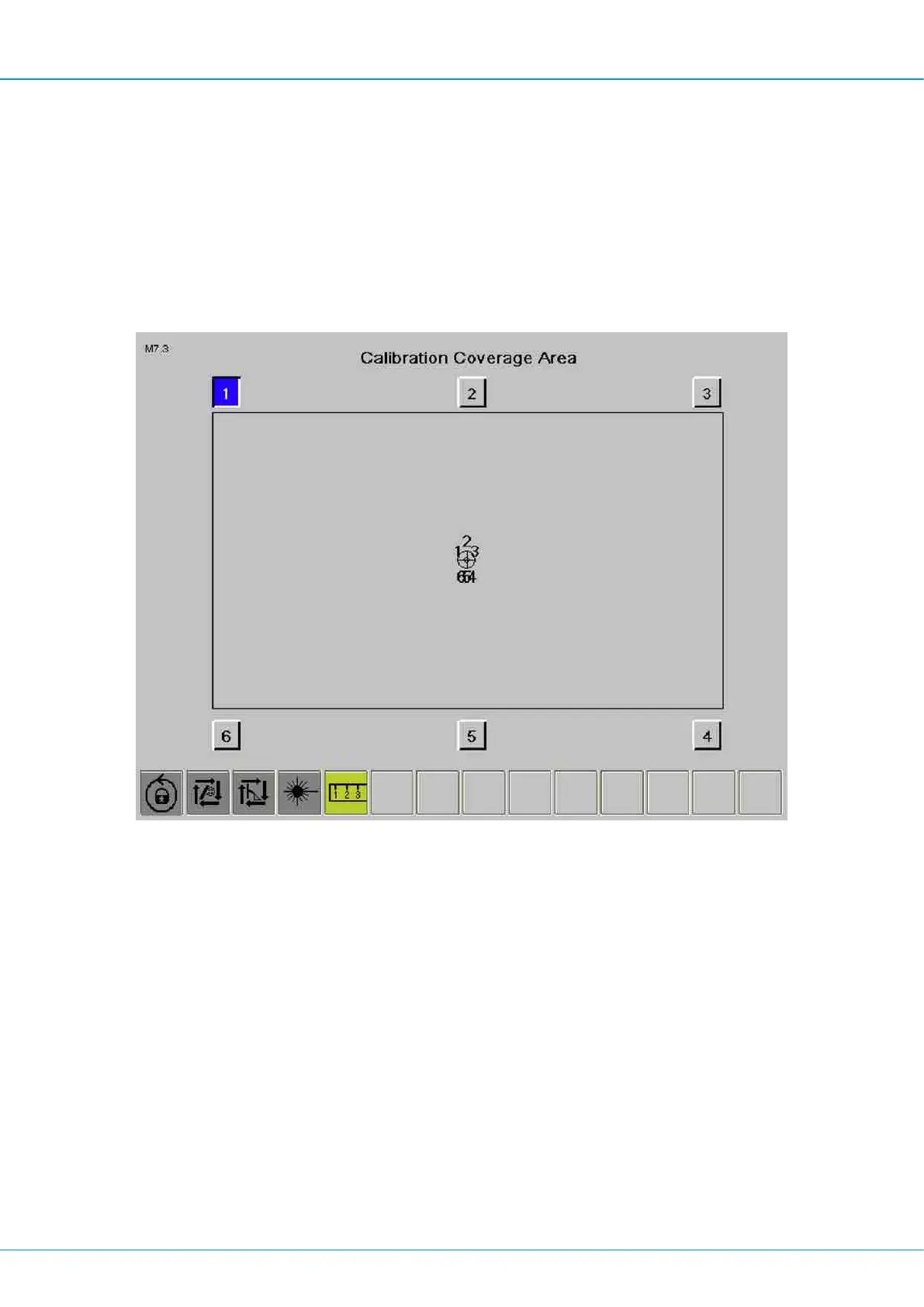
Calibrating the coverage area
Calibration Coverage Area
The rig must be level before calibration begins.
Start by parking the rig on a level surface. Then use the track oscillation and level the rig
using the spirit level in the cabin.
Then lock the track oscillation. Activate drilling position.
n Position the boom system max left and as far forward as possible with vertical feed
and feed extension max up. Then press Box 1.
n Position the boom system straight forward and as far forward as possible with vertical
feed and feed extension max up. Then press Box 2.
n Position the boom system max right and as far forward as possible with vertical feed
and feed extension max up. Then press Box 3.
n Position the boom system max right and as close to the rig as possible with vertical
feed and feed extension max up. Then press Box 4.
n Position the boom system straight forward and as close to the rig as possible with ver-
tical feed and feed extension max up. Then press Box 5.
n Position the boom system max left and as close to the rig as possible with vertical feed
and feed extension max up. Then press Box 6.
 Loading...