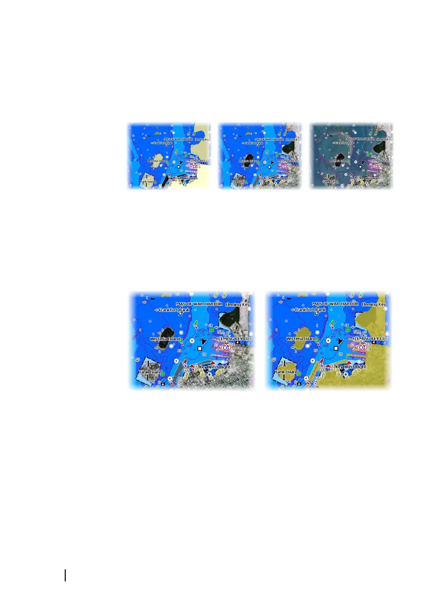
Photo overlay
Photo overlay enables you to view satellite photo images of an area
as an overlay on the chart. The availability of such photos is limited
to certain regions, and cartography versions.
You can view photo overlays in either 2D or 3D modes.
No Photo overlay Photo overlay, land only Full Photo overlay
Photo transparency
The Photo transparency sets the opaqueness of the photo overlay.
With minimum transparency settings the chart details are almost
hidden by the photo.
Minimum transparency Transparency at 80
44
Charts | GO XSE Operator Manual