4 Measurement screen
This value Shows the…
Inward/Outward difference in offset to a selected point relative to the selected alignment.
Feature 2 cut/fill Cut/Fill 1–2 when using a primary and underlying surface.
Feature 2 design
elevation
design elevation of a selected point, line, road, or alignment.
Dsn Sta station to a selected point per design.
Stakeout line offset
H
currently-applied horizontal line offset.
Stakeout line offset
V
currently-applied vertical line offset.
Surface offset currently-applied surface offset.
Cut/Fill 1 Cut/Fill values referenced to the primary surface.
Cut/Fill 2 Cut/Fill values referenced to the secondary surface.
Design Elevation 1 design elevation referenced to the secondary surface.
Design Elevation 2 design elevation referenced to the secondary surface.
Cut/Fill between
surfaces
distance between the primary and secondary surface at this location.
Second surface
settings
surface offset for secondary surface.
FXL code description for the selected feature code.
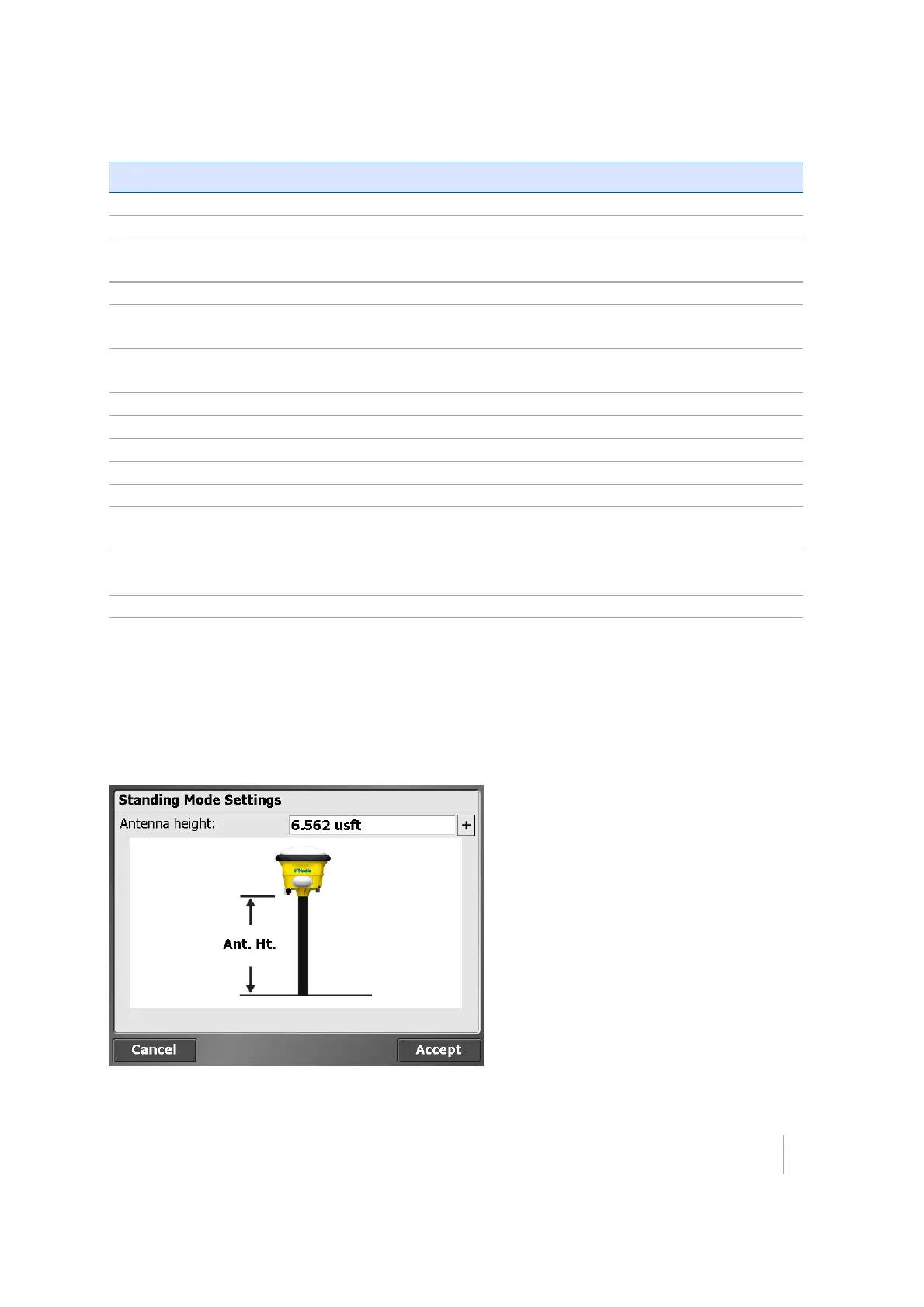
Antenna Height / Target Height
To change the antenna or target height, tap on the value in the info bar. This value is subtracted
from each GPS elevation or elevation measured with a total station. If the antenna/target height is
currently not displayed in the info bar, turn it on in the Trimble icon menu using the Configure Info
Bars option.
Trimble SCS900 Site Controller Software User Guide 35