7 Volume and COGO
To convert a polyline of the current loaded design or work order in an alignment, tap Map.
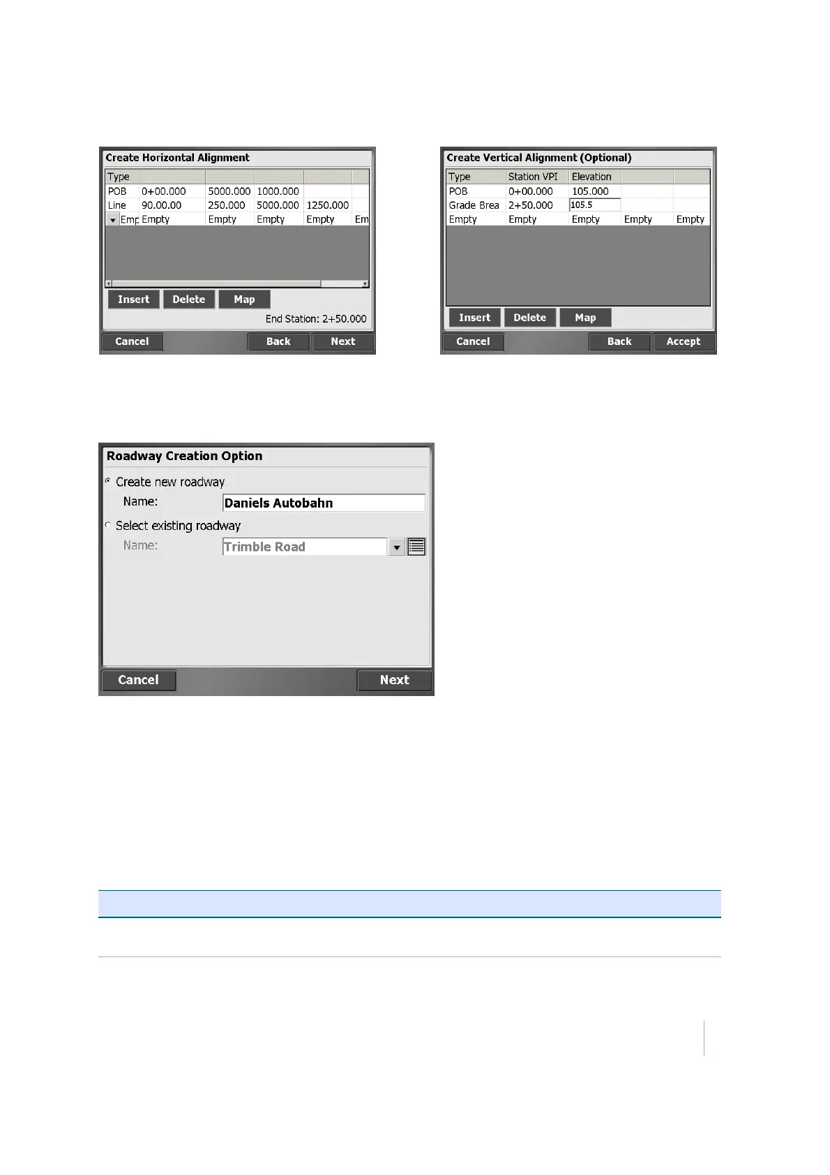
If roads already exist in the current design that were created in the SCS900 software, you are
prompted to choose to edit an existing road or create a new one:
Complete the numeric boxes to define it.
The following table shows the record types that the SCS900 software supports and the data that
you must enter for each type. Depending on the Key In Road settings, the alignment can be entered
via segments or via coordinates for the points of intersections. The POB is the Point Of Beginning,
which is always the first record for a horizontal alignment and contains the start station and
coordinates. The azimuth is always automatically computed and appears in the table as Tangent. If
you tap on this field, the software displays the actual calculated azimuth. If required, you can
overwrite it with your own value. You can also enter the azimuth as a bearing (that is, S 90 W =
azimuth of 270°).
Record type Col1 Col2 Col3 Col4
POB (Point of
Beginning)
Station Northing Easting
Trimble SCS900 Site Controller Software User Guide 59